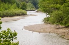
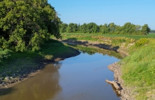
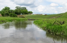
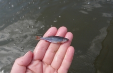
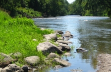
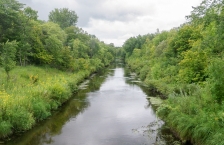
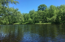
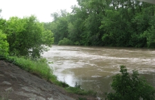
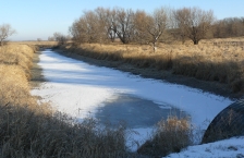
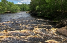
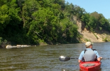
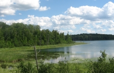
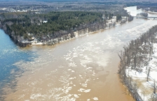
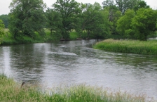
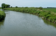
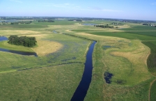
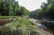
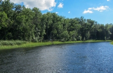
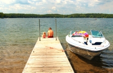
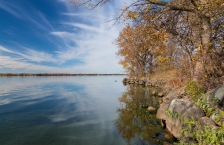
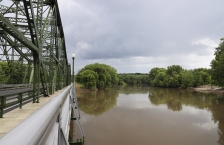
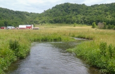
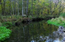
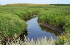
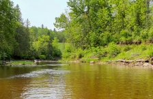
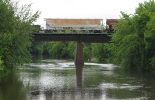
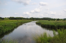
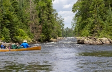
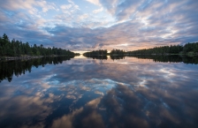
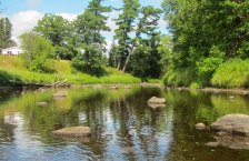
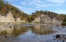
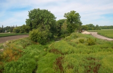
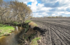
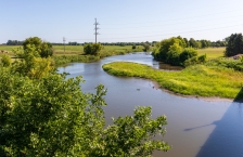
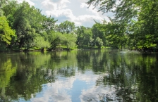
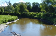
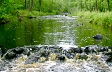
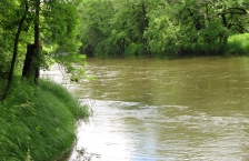
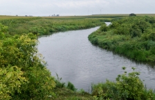
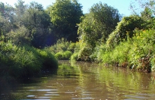
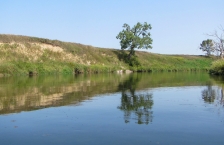
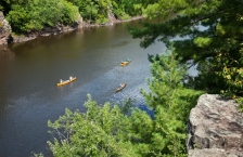
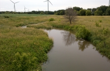
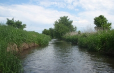
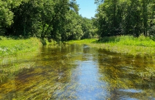
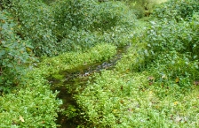
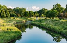
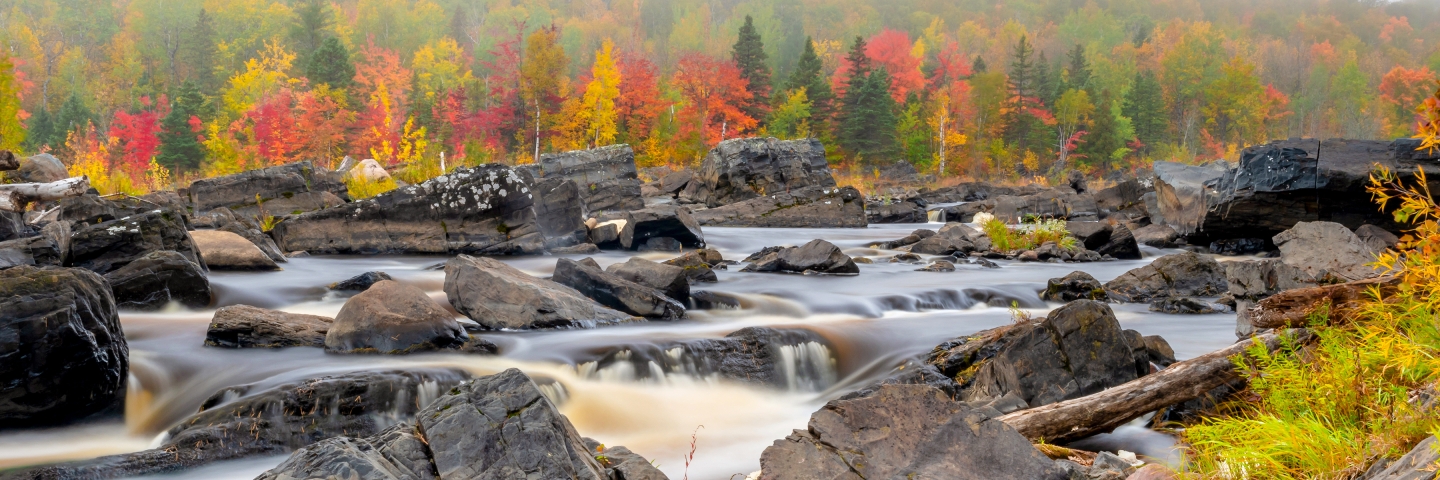
Minnesota watershed information

Big Fork River

The Big Fork River watershed covers 1,326,947 acres; the river flows north 165 miles from Dora Lake (45 miles northeast of Bemidji in north-central Itasca County) to the Rainy River, which forms the Minnesota/Canadian border.

Blue Earth River

The Blue Earth River begins in northern Iowa and meets with the West Branch Blue Earth River in Faribault County. The watershed includes parts of eight counties in southern Minnesota and four in northern Iowa.

Bois de Sioux River

The Bois de Sioux River watershed covers 718,685 acres, and includes the drainage basins of Lake Traverse and the Bois de Sioux River.

Buffalo River

The Buffalo River Watershed covers more than 1,100 square miles in portions of Becker, Clay, Otter Tail, and Wilkin counties.

Cannon River

The Cannon River watershed is located south of the Twin Cities and encompasses areas of Dakota, Goodhue, Le Sueur, Steele, Rice and Waseca counties.

Cedar River

The Cedar River watershed in Minnesota encompasses 454,029 acres in Mower, Freeborn, Dodge, and Steele counties. This watershed covers prime agricultural land with many streams and drainage ditches flowing into the river.

Chippewa River

The Chippewa River watershed covers 2,085 square miles and drains portions of eight counties in west central Minnesota.

Clearwater River

The Clearwater River watershed drains an area of 886,600 acres in the Red River of the North basin. The river flows to the northwest and southwest, eventually emptying into Red Lake River near Red Lake Falls.

Cloquet River

The Cloquet River watershed covers approximately 507,858 acres (794 square miles) and is located within portions of Lake and St. Louis Counties in northeastern Minnesota.

Cottonwood River

The Cottonwood River is located in southwestern Minnesota in the counties of Brown, Cottonwood, Lyon, Murray, and Redwood. It begins near Balaton in southwest Lyon County.

Crow Wing River

The Crow Wing River Watershed is located in north-central Minnesota and covers approximately 1,946 square miles within Becker, Cass, Clearwater, Crow Wing, Hubbard, Morrison, Otter Tail, Todd, and Wadena Counties.

Des Moines River - Headwaters

The Des Moines River - Headwaters watershed is located in southwestern Minnesota. It covers approximately 1,334 square miles including parts of Lyon, Pipestone, Murray, Cottonwood, Nobles, Jackson, and Martin counties.

Duluth Urban Area Watershed

The Duluth Urban Area Watershed is a focused geographic area designed to recognize the complexity and challenges in an urban center with a water-rich environment. It is defined by a series of small watersheds that are portions of three major watersheds.

East Fork Des Moines River

The East Fork Des Moines River watershed covers 839,518 acres, which includes Minnesota's Martin and Jackson counties.

Kettle River

The Kettle River watershed covers 672,235 acres in northeast Minnesota, covering parts of Aitkin, Carlton, Kanabec, and Pine counties.

Lac qui Parle River

The Lac qui Parle watershed covers approximately 1,100 square miles and drains parts of Lac qui Parle, Lincoln, and Yellow Medicine counties in Minnesota as well as parts of Grant, Deuel, and Brookings counties in South Dakota.

Lake of the Woods

The Lake of the Woods lies on the border between the U.S. and Canada; the watershed covers 734,783 acres.

Lake Superior - North

The Lake Superior - North watershed covers over 1 million acres in the Northern Lakes and Forest ecoregion.

Lake Superior - South

The Lake Superior - South watershed covers 402,371 acres.

Le Sueur River

Located in south-central Minnesota, the Le Sueur River flows 111 miles through a gently rolling landscape, most of it farmland, until it cuts down through high bluffs to the Blue Earth River.

Leech Lake River

The Leech Lake River watershed consists of approximately 854,659 acres (1,335 sq. miles) in the northern part of the Upper Mississippi River Basin. The watershed includes parts of Beltrami, Cass, and Hubbard counties and the Leech Lake Reservation (Leech Lake Band of Chippewa).

Little Fork River

The Little Fork River watershed is 1,179,520 acres, the main stem flowing 160 miles through north-central St. Louis County and heading northwest into Koochiching County. It flows more northerly until it reaches its confluence with the Rainy River about 11 miles west of International Falls.

Little Sioux River

The Little Sioux River watershed covers 1,812,406 acres in southwestern Minnesota. Its small prairie streams flow through the southern portions of Nobles and Jackson counties and into Iowa.

Long Prairie River

The Long Prairie River watershed covers approximately 565,078 acres and is located in the central part of the Upper Mississippi River Basin in central Minnesota. The watershed encompasses parts of Douglas, Otter Tail, Todd, Morrison and Wadena counties.

Lower Big Sioux River

The Lower Big Sioux River watershed covers 2,188,399 acres, mostly located in eastern South Dakota. A small portion lies in western parts of Lincoln, Pipestone, and Rock counties in southwestern Minnesota. There are several small to medium-sized tributaries.

Lower Des Moines River

The Lower Des Moines River watershed is located in southwestern Minnesota. It covers approximately 703,000 acres.

Lower Minnesota River

The Lower Minnesota River watershed includes the lowest reach of the Minnesota River and flows into the Mississippi at Fort Snelling. The second-largest watershed in the Minnesota River Basin, it covers 1,760 square miles, divided by the Minnesota River itself.

Lower Rainy River

The Lower Rainy River Watershed is composed of a conglomeration of tributaries to the Rainy River, from International Falls and west to the Rainy River's pour point at the Lake of the Woods.

Lower Red River/Red River of the North - Tamarac River

The Lower Red River watershed (also known as the Red River of the North - Tamarac River) drains an area of 281,000 acres, including parts of Kittson, Marshall, and Roseau counties.

Lower St. Croix River

The Lower St. Croix watershed covers 585,735 acres and is located in northwest Wisconsin and east-central Minnesota.

Minnesota River - Headwaters

The Minnesota River - Headwaters watershed covers 487,015 acres in the Prairie Parkland ecoregion of southwestern Minnesota. Portions of Traverse, Big Stone, Swift, Lac qui Parle, Stevens, and Chippewa counties drain the watershed.

Minnesota River - Mankato

The Minnesota River-Mankato watershed covers 861,886 acres across Cottonwood, Brown, Redwood, Renville, Sibley, Nicollet, Blue Earth, and Le Sueur counties in south-central Minnesota.

Minnesota River - Yellow Medicine River/Hawk Creek

The Minnesota River - Yellow Medicine River watershed (1.3 million acres) has traditionally been managed as two separate watersheds, the Hawk Creek watershed to the north of the Minnesota River and the Yellow Medicine River watershed to the south.

Mississippi River - Brainerd

The Mississippi River - Brainerd watershed covers 1,079,950 acres in the north-central part of the Upper Mississippi River Basin in central Minnesota. The watershed encompasses all or parts of Aitkin, Cass, Crow Wing, Morrison, and Todd counties.

Mississippi River - Grand Rapids

The Mississippi River - Grand Rapids watershed covers 1,316,071 acres and contains 1,908 miles of stream/rivers and 552 lakes greater than 10 acres. The watershed drainage comprises parts of the counties of Aitkin, Carlton, Cass, Itasca, and St. Louis.

Mississippi River - Headwaters

The Mississippi River - Headwaters watershed consists of 1,255,105 acres (1,961 square miles) and contains the headwaters of the Mississippi River at Lake Itasca in Itasca State Park. The watershed includes parts of Becker, Beltrami, Cass, Clearwater, Hubbard and Itasca counties.

Mississippi River - La Crescent

The Mississippi River - La Crescent watershed drains 95 square miles in Houston and southeast Winona counties, an area defined by wooded bluffs and spring-fed cold-water streams that flow directly to the Mississippi River.

Mississippi River - Lake Pepin

The Mississippi River - Lake Pepin watershed includes 205,747 acres that drain several small, coldwater streams in bedrock-dominated bluff country.

Mississippi River - Reno

This watershed is located in the southeastern tip of Minnesota, known for its scenic bluffs. More than 900,000 acres drain to the Mississippi River at Reno, Minn., but only 117,000 of those acres are in Minnesota.

Mississippi River - Sartell

The Mississippi River - Sartell watershed covers approximately 652,800 acres (1,020 sq. miles) in the central part of the Upper Mississippi River Basin. The watershed includes parts of Benton, Crow Wing, Mille Lacs, Morrison, Stearns, and Todd counties.

Mississippi River - St. Cloud

The Mississippi River - St. Cloud watershed covers 691,200 acres (1,080 square miles) in the south-central part of the Upper Mississippi River Basin. The watershed includes all or parts of the counties of Benton, Meeker, Mille Lacs, Morrison, Sherburne, Stearns, and Wright.

Mississippi River - Twin Cities

The Mississippi River - Twin Cities watershed is 656,990 acres and lies almost entirely in the North Central Hardwoods Forest ecoregion in the Mississippi River Basin. The watershed contains 1,320 stream miles and 380 lakes. More than 1.8 million people live in this watershed.

Mississippi River - Winona

The Mississippi River - Winona watershed covers 419,200 acres in Wabasha, Winona, and Olmsted counties in southeast Minnesota. A majority of the watershed is cropland, with forest and grassland covering large portions as well.

Mustinka River

The Mustinka River begins its course southwest of Fergus Falls in southwestern Otter Tail County and flows towards the south into Grant County, where it continues through Stony Brook Lake and Lightning Lake.

Nemadji River

The Nemadji River watershed spans the Minnesota-Wisconsin border and covers nearly 1.2 million acres.

North Fork Crow River

The North Fork Crow River watershed covers 949,107 acres.

Otter Tail River

The Otter Tail River watershed encompasses three different ecoregions, covering more than 1.2 million acres in west-central Minnesota.

Pine River

The Pine River watershed is approximately 502,400 acres in size. The watershed drainage for the Pine River contains parts of Aitkin, Cass, Crow Wing and Hubbard counties. Pine River and Crosslake are the major cities in the watershed.

Pomme de Terre River

The Pomme de Terre River begins cool and clear in Otter Tail County, bordered by wooded hills and grassy meadows. It flows south through several lakes; as the river nears its mouth, it is bordered by eroding banks, becoming increasingly muddy before discharging into the Minnesota River at Marsh Lake.

Rainy River - Headwaters

The Rainy River - Headwaters watershed covers 1,890,689 acres, starting in northern Cook and Lake Counties and flowing west/northwesterly into St. Louis County and the Canadian border waters.

Rainy River - Rainy Lake

The Rainy River - Rainy Lake watershed covers 583,791 acres. Open water makes up 75,815 of those acres and wetlands occupy another 84,851 acres. The watershed is 64% in St. Louis County and 36% in Koochiching County. The northern boundary is part of the international border waters with Ontario, Canada.

Rapid River

The Rapid River watershed covers 573,060 acres in northern Minnesota. Over 79% of the land in the watershed is owned or managed by state entities.

Red Lake River

The Red Lake River watershed, which covers 909,024 acres, is part of the Red River Basin in northwestern Minnesota. The Red Lake River begins its course in Beltrami County at Lower Red Lake.

Red River of the North - Grand Marais Creek

The Red River of the North - Grand Marais Creek watershed covers 298,264 acres and is part of the Red River Basin in northwestern Minnesota and southeastern North Dakota.

Red River of the North - Marsh River

The Red River of the North - Marsh River watershed is part of the Red River Basin in northwestern Minnesota and southeastern North Dakota.

Red River of the North - Sand Hill River

The Red River of the North - Sand Hill River watershed covers 708,469 acres and is part of the Red River Basin in northwestern Minnesota and southeastern North Dakota.

Redeye River

The Redeye River watershed covers 575,366 acres (899 square miles) and is located the northwestern to north-central part of the Upper Mississippi River Basin in central Minnesota. The watershed encompasses all or parts of Becker, Otter Tail, Todd, and Wadena counties.

Redwood River

The Redwood River is located in southwestern Minnesota in the counties of Lincoln, Lyon, Murray, Pipestone, Redwood, and Yellow Medicine.

Rock River

The Rock River watershed covers more than 1 million acres in Rock, Nobles, Pipestone and Murray counties in southwestern Minnesota. It is the largest of the four watersheds in Minnesota that are part of the Missouri River Basin, extending south into Iowa.

Root River

The Root River starts as a drainage ditch in Mower County, then winds 81 miles from intensely farmed areas through more wooded, rolling terrain, and finally empties into the Mississippi River south of La Crosse, Wisconsin. Near Forestville State Park, the river literally disappears underground and resurfaces at the Mystery Cave near Preston.

Roseau River

The Minnesota portion of the Roseau River watershed covers 774,197 acres; an additional 594,560 acres are across the U.S. border in Canada.

Rum River

The Rum River watershed covers 997,060 acres in east-central Minnesota, covering parts of Aitkin, Crow Wing, Morrison, Mille Lacs, Kanabec, Benton, Isanti, Chisago, Sherburne, and Anoka counties.

Sauk River

The Sauk River watershed covers 667,200 acres (1,043 square miles) and extends from the Mississippi River near St. Cloud to within 3 miles of Alexandria.

Shell Rock River

The Shell Rock River begins at Albert Lea Lake in Freeborn County in south-central Minnesota, a few miles from the Iowa border. It flows 113 miles into Iowa, where it enters the Cedar River. In Minnesota, the Shell Rock drains 246 square miles (160,000 acres), all in Freeborn County.

Snake River - Red River Basin

The Snake River begins its 50-mile course in Marshall County and drains an area of 611,800 acres. The Snake River Watershed lies within Marshall, Polk, and Pennington Counties in NW Minnesota.

Snake River - St. Croix Basin

The Snake River watershed is located north of the Twin Cities in the St. Croix River Basin and encompasses 1,006 square miles in five counties: Aitkin, Kanabec, Mille Lacs, Pine, and Isanti.

South Fork Crow River

The South Fork Crow River watershed covers 818,428 acres. It is located in south-central Minnesota and encompasses parts of Kandiyohi, Renville, Meeker, McLeod, Sibley, Wright, Carver, and Hennepin counties.

St. Louis River

The St. Louis River watershed covers 3,584 square miles at the head of the Great Lakes and represents the extreme headwaters of the St. Lawrence River.

Thief River

The Thief River begins its course in Marshall County at Thief Lake, flowing south/southwest to converge with the Red Lake River.

Two Rivers

The Two Rivers watershed is part of the Red River Basin in northwestern Minnesota. Two Rivers actually consists of three branches: the North, Middle, and South Branch.

Upper Big Sioux River

Only a very small portion of the 1.35-million-acre Upper Big Sioux River watershed is located in Lincoln County in western Minnesota. The vast majority is located in eastern South Dakota.

Upper Iowa River

The Upper Iowa River is a 156-mile-long tributary of the Mississippi River that rises in Mower County in southeastern Minnesota near the Iowa border. It then flows south through three Iowa counties before flowing into the Mississippi. It drains nearly 641,000 acres (1,005 square miles).

Upper Red River of the North

The Upper Red River watershed drains an area of 371,689 acres in the Glacial Lake Agassiz Plain, while the extreme southeastern portion of the basin lies in the North Central Hardwoods ecoregion. The Red River begins its course just below Breckenridge, Minn.

Upper St. Croix River

Streams of the Upper St. Croix Watershed are among the most biologically intact, healthy, and resilient of watersheds in Minnesota.

Upper Wapsipinicon River

Located in southeast Minnesota and northeast Iowa, the Upper Wapsipinicon watershed lies within the Eastern Iowa and Minnesota Drift Plains portion of the Western Corn Belt Plains ecoregion.

Upper/Lower Red Lake

The Upper/Lower Red Lake watershed covers more than 1.2 million acres and is home to Upper and Lower Red Lakes, the two largest bodies of water within the state.

Vermilion River

The Vermilion River watershed, located within northern St. Louis County, covers 662,427 acres, or 1,035 square miles.

Watonwan River

One of 12 major watersheds of the Minnesota River Basin, the Watonwan River watershed covers 878 square miles in south-central Minnesota.

Wild Rice River

The Wild Rice River begins its course at Mud Lake in Minnesota's Clearwater County, and flows largely to the west through Norman and Mahnomen counties.

Winnebago River

This Winnebago River consists of a stream and lake system in southern Minnesota that flows into Iowa. The water resources here face several water quality challenges, including high nutrient and bacteria levels.

Zumbro River

The Zumbro River watershed covers more than 900,000 acres and reaches parts of six counties in southeast Minnesota (Olmsted, Dodge, Steele, Rice, Goodhue, and Wabasha). Rochester, one of Minnesota's largest cities, is located in the southeast quadrant of the watershed.