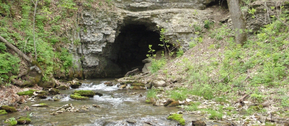
The Root River starts as a drainage ditch in Mower County, then winds 81 miles from intensely farmed areas through more wooded, rolling terrain, and finally empties into the Mississippi River south of La Crosse, Wisconsin. Near Forestville State Park, the river literally disappears underground and resurfaces at the Mystery Cave near Preston.
Pollution from indirect sources such as runoff is the main water quality problem in the Root River watershed. Soil and nutrients enter the watershed’s many rivers and streams from urban and rural areas. Reducing these pollutants across a diverse landscape is the top challenge for water quality. The karst topography of the Root River watershed raises concerns about surface and groundwater mixing.
Monitoring and assessment
Intensive water monitoring found 30 sections of streams to be impaired waters, meaning the stream sections fail to meet water quality standards.
Strategy development for restoration and protection
Local partners like the Fillmore Soil and Water Conservation District continue to implement strategies to reduce sediment, nitrate and bacteria in the Root River and its tributaries. The strategies in the Watershed Restoration and Protection Strategies (WRAPS) were developed by local partners and citizens. Friends of the Root River (FORR), a citizen group working to protect and restore the river, also plays an important role.
- (EPA approval on 5/21/2024)
- (MPCA approval 4/23/24)
- (MPCA approval 4/23/24)
- (MPCA approval 11/16/16)
- (EPA approval 2/16/2017)
- (EPA approval 1/29/2026)
More information
- Root River One Watershed One Plan
- Root River Field to Stream Partnership (Minnesota Department of Agriculture)
- Root River Soil and Water Conservation District
- Fillmore Soil and Water Conservation District
- Mower Soil and Water Conservation District
- Olmsted Soil and Water Conservation District
- Winona County Soil and Water Conservation District