The Blue Earth River begins in northern Iowa and meets with the West Branch Blue Earth River in Faribault County in southern Minnesota. From there, it flows 108 miles northwardly in a winding course through eastern Faribault County into Blue Earth County, past the cities of Blue Earth, Winnebago, and Vernon Center to Mankato, where it enters the Minnesota River. Altogether, the watershed includes parts of eight counties in southern Minnesota — primarily Martin and Faribault — and four in northern Iowa. There are 21 cities in the watershed, of which Mankato and Fairmont are the largest.
The Blue Earth River major watershed area is about 1,550 square miles or 992,034 acres. The Blue Earth River, along with the city and county, were named for former deposits of bluish-green clay, no longer visible, along the banks of the river. The combination of erodible soils and higher flows has led to greater levels of erosion and a dramatic increase in sediment levels in the river system since European settlement in the late 1800s. Sediment makes the water cloudy and hurts aquatic life such as fish.
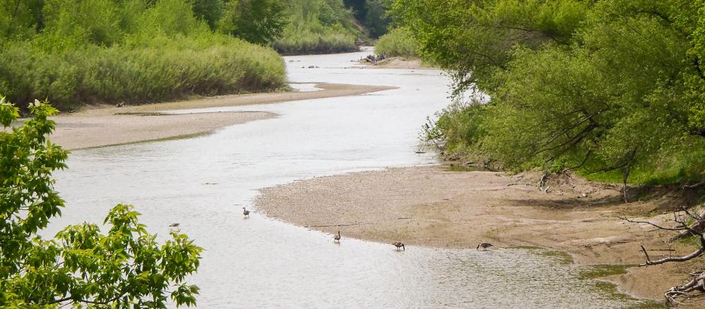
By volume, the Blue Earth is the Minnesota River's largest tributary, accounting for 46% of the Minnesota's flow at the rivers' confluence. It also is a major contributor of sediment to the Minnesota River. The landscape is mainly flat, though it includes some hilly areas, ravines, bluffs, natural prairies and forested areas. The vast majority of the watershed is farmland.
The Blue Earth River was the site of a dramatic scene on June 24, 2024, when floodwaters eroded the bluff around the Rapidan Dam, 12 miles upstream from the river’s mouth. The dam was constructed to generate hydroelectricity in 1910. Since its partial failure, the river is free-flowing from the farmland banks and bluffs by the town of Blue Earth to the gorge below, where the river runs through canyons, waterfalls, and great limestone cliffs. The rapids below the dam were filled with sediment after the dam failed, but those rapids will return over time. Numerous teams are studying the biological and chemical repercussions of the dam failure, including teams from the MPCA, the Minnesota Department of Natural Resources, Mankato State University, and the University of Minnesota. As of 2025, multiple agencies are making plans to remove the dam and replace a nearby bridge.
In the Greater Blue Earth River basin, 39 sections of streams and rivers fail to meet the state water quality standard for turbidity, meaning the water is too cloudy and affects aquatic life such as fish. Under state standards, the level of total suspended solids for rivers in the basin should be 90 parts per million. However, levels average between 175 to 675 parts per million according to water monitoring from 2000-2008.
Several stretches of streams in the Greater Blue Earth River also have bacteria levels high enough to violate the state water quality standard, indicating they are not suitable for swimming and other body-contact recreation. Restoring these streams will require reducing bacteria levels by 80 to 90%.
The MPCA is working with local partners, focusing on feedlots and failing septic systems, to reduce bacteria levels and make streams suitable for swimming and other body-contact recreation. As part of the Minnesota River Basin, the Blue Earth and its tributaries have been the subject of several scientific studies, including research by the MPCA, WRC-Minnesota State University-Mankato, University of Minnesota, National Center for Earth Surface Dynamics, Minnesota Dept. of Agriculture and others.
The MPCA and several other agencies monitor the water quality of the rivers and streams in the watershed, an effort that spans more than 20 years. The MPCA has finalized a total suspended solids (TSS) total maximum daily load (TMDL) report for the Greater Blue Earth River Basin. MPCA recommends a 0% reduction in sediment levels during low-flow conditions and up to a 93% reduction in sediment levels during high-flow conditions such as spring thaw. With this information and other reports from the watershed, the MPCA will work with stakeholders to develop a watershed restoration and protection strategy (WRAPS) as part of the Blue Earth watershed approach.
Monitoring and assessment
Strategy development for restoration and protection
- (EPA approval 8/1/2023)
- (MPCA approval 6/20/2023)
- (EPA approval 6/7/2007)
- (MPCA approval 11/14/07)