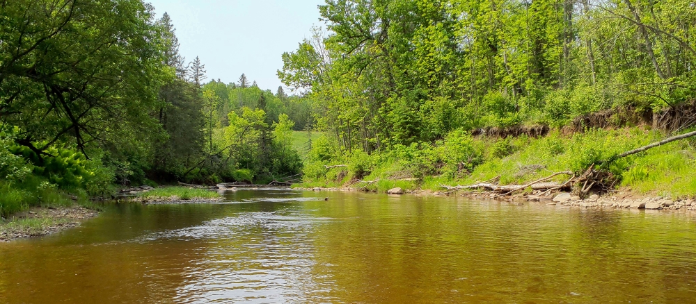
The Nemadji River Watershed spans the Minnesota-Wisconsin border and covers 1,180,073 acres. The Minnesota portion of the watershed is about 178,000 acres and is located in the Northern Lakes and Forest Ecoregion, an area dominated by glacial till in ground moraines and drumlins and highly erodible lake-laid clay soils. The Nemadji River and its many tributaries are the main river system within the Minnesota watershed area. It flows 65 miles from its headwaters in Pine County, through Carlton County, and then crosses into Wisconsin, finally exiting into Lake Superior within the city of Superior. Other communities in the watershed’s Minnesota portion include Carlton and Wrenshall.
The Nemadji watershed includes numerous streams, which are tributaries to the mainstem of the Nemadji River, and a few lakes located in the watershed’s headwaters area. Land use in the watershed’s Minnesota portion is mostly related to rural forestry, pasture production for hay cutting, and some beef cattle. Lakeshores are developed, although not as intensively as is typical in northern counties.
Currently the mainstem of the Nemadji River, from its headwaters to the Wisconsin border, and two tributaries do not meet water quality standards for beneficial uses such as aquatic recreation, drinking, and swimming due to a turbidity impairment. In this watershed, turbidity is associated with suspended sediment. It is likely that after more monitoring, additional tributaries will not meet the current turbidity standard.
Duluth Urban Area Watershed
This watershed overlaps with the Duluth Urban Area Watershed, an area designated to address the complexity of a water-rich, densely populated urban center. The MPCA is working with a range of partners to monitor water quality in Duluth streams and develop restoration and protection strategies.
Monitoring and assessment
The mainstem of the Nemadji is monitored for water chemistry via the Watershed Pollutant Load Monitoring Network. One other mainstem location is monitored for long-term climate change impacts to the stream. The Carlton Soil and Water Conservation District and volunteer monitors also collect data annually for specific project areas.
Strategy development for restoration and protection
- (EPA approval 8/16/2017)
- (MPCA approval 6/14/2017)
- (EPA approval 8/12/2013)
- (MPCA approval 4/1/2014)