The Watonwan River Watershed covers approximately 878 square miles (561,620 acres), and is of 12 major watersheds of the Minnesota River Basin. It is located in south-central Minnesota within Blue Earth, Brown, Cottonwood, Jackson, Martin, and Watonwan counties. There are 12 municipalities in the watershed, of which the city of St. James is the largest.
The Watonwan River rises in central Cottonwood County and flows 113 miles through flat farmland in northern Watonwan and western Blue Earth counties, past the city of Madelia, until it flows into the Blue Earth River about 8 miles southwest of Mankato. Much of the river has been straightened and altered to provide for drainage of farmland and for flood reduction.
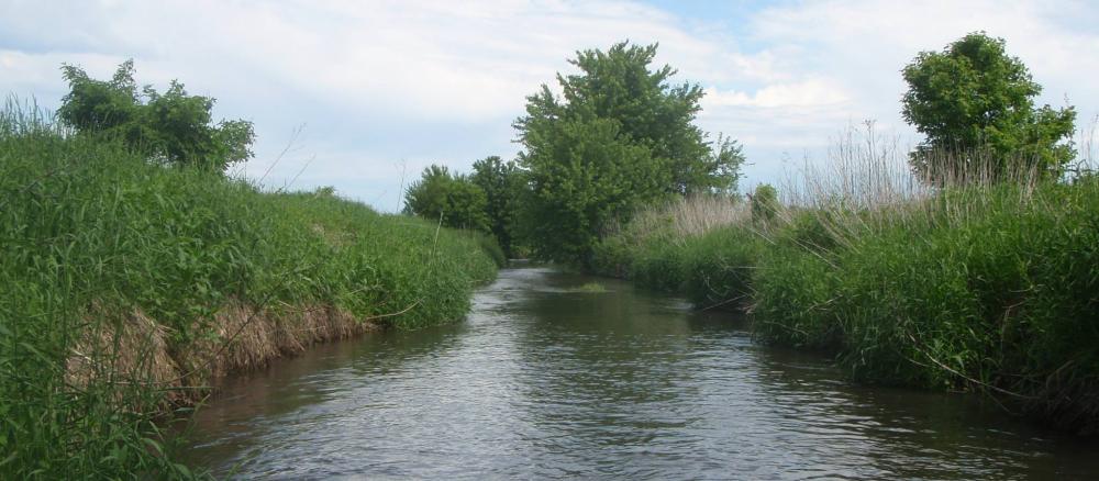
The Watonwan River offers a peaceful and scenic float for paddlers until the rapids generally increase as the river nears its confluence with the Blue Earth River above the Rapidan dam. In Madelia, Watona Park is nestled along the banks of the Watonwan River and features many amenities, including a campground.
Much of the river has been straightened and altered to provide for drainage of farmland and flood reduction. Though the vast majority of the watershed is used for farming, mainly corn and soybeans, small lakes and wetlands provide significant habitat for waterfowl.
Like most areas of the Minnesota River Basin, the soils here are highly erodible. Changes in climate and the landscape have resulted in higher flows in the river system. The combination of erodible soils and higher flows has led to greater levels of erosion and a dramatic increase in sediment levels in the river system since European settlement in the late 1800s. Sediment makes the water cloudy and hurts aquatic life such as fish.
The Watonwan River and the Le Sueur River are the largest tributaries to the Blue Earth River. Together, these watersheds make up the Greater Blue Earth River Basin, which drains 5,540 square miles (2.3 million acres) in 11 counties in Minnesota and three in Iowa.
By volume, the Blue Earth is the Minnesota River's largest tributary, accounting for 46 percent of the Minnesota's flow at the rivers' confluence. It also a major contributor of sediment to the Minnesota River. In the Greater Blue Earth River Basin, 39 sections of streams and rivers fail to meet the state water quality standard for turbidity, meaning the water is too cloudy and affects aquatic life such as fish.
Several stretches of streams in the Greater Blue Earth River also have bacteria levels high enough to violate the state water quality standard, indicating they are not suitable for swimming and other body-contact recreation. Restoring these streams will require reducing bacteria levels by 80 to 90 percent.
Monitoring and assessment
Strategy development for restoration and protection
- (MPCA approval 1/23/2020)
- (EPA approval 4/7/2020)
Blue Earth River fecal coliform TMDL
- (EPA approval 6/7/2007)
- (MPCA approval 11/14/07)