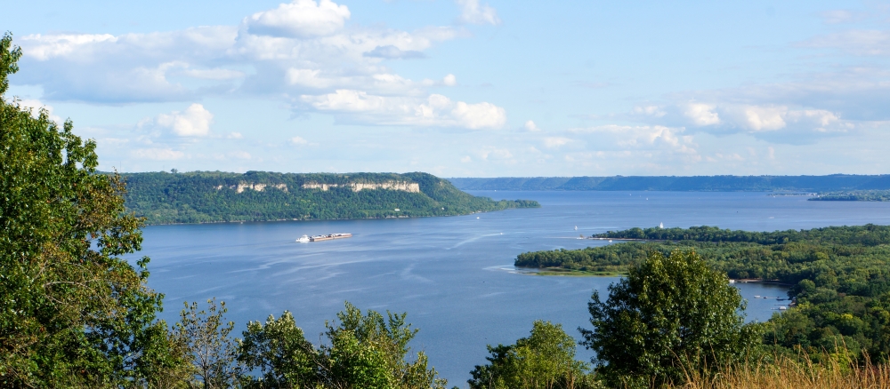
The Mississippi River - Lake Pepin Watershed includes 205,747 acres that drain several small coldwater streams in bedrock-dominated bluff country.
In Minnesota, the watershed encompasses three distinct areas: Lake Pepin itself, the Lake Pepin tributary streams to the south, and the Vermillion River watershed to the north. These three areas face different challenges.
Monitoring and assessment
Lake Pepin
Lake Pepin is a naturally occurring lake in the Mississippi River formed by the backup of water behind the sedimentary deposit of the Chippewa River’s delta on the Wisconsin side. The lake is 21 miles long, averages 1.7 miles wide, and covers 29,295 acres. It has a maximum depth of 60 feet and an average depth of 18 feet. Roughly half of Minnesota’s total land area — including the Upper Mississippi, St. Croix, and Minnesota rivers — plus small portions of three neighboring states drains into Lake Pepin.
The MPCA assessed Lake Pepin in 2002 and found nutrient levels too high to meet state water quality standards designed to ensure that lakes and streams are fishable and swimmable. The MPCA then began a total maximum daily load (TMDL) study of excess nutrients in the lake, which cause excessive algal growth. The lake also has high levels of sediment carried in by major river systems. The sediment is filling in the lake at a much faster rate than would naturally occur.
Several MPCA studies describe sediment sources, transport mechanisms, and large-scale reduction strategies to reduce sediment loading in the watershed:
- Lake Pepin Watershed excess nutrients TMDL
- South Metro Mississippi turbidity TMDL
- Minnesota River and Greater Blue Earth River Basin TMDL for total suspended solids
- Sediment reduction strategy (Minnesota River Basin and South Metro Mississippi River)
Reducing sediment will also reduce nonpoint phosphorus loading, which is often the cause of excessive algal growth.
As a result of many studies, the MPCA developed site-specific eutrophication criteria for Lake Pepin, which were approved by the U.S. EPA. These criteria are not stand-alone goals to be pursued in isolation. Rather, they are part of the goals for the Mississippi River system, which, if pursued systematically and concurrently, will achieve the desired results.
Lake Pepin is a complex ecosystem with an expansive watershed. The lake is important to the state for economic, environmental, and cultural reasons. State agencies and local partners are working together to implement projects to reduce the level of nutrients and sediment flowing into Lake Pepin from the rivers that feed it and to restore in-lake habitat. These efforts have a ripple effect all the way to the Gulf of Mexico, where high nutrient levels have created a hypoxic area or “dead zone.”
Lake Pepin Tributaries
The Lake Pepin Tributaries watershed includes about 114,000 acres that are drained by several small, coldwater streams in bedrock-dominated bluff country and karst topography. There are five named streams in this small watershed, many of which are designated trout streams: Wells Creek, Hay Creek, Gilbert Creek, Miller Creek, and Bullard Creek. This watershed consists of forests, blufflands, and cultivated lands. The top of the watershed is composed of rolling cropland interspersed by many small tributaries that drop steeply through forested valleys with scattered prairies atop limestone cliffs. Agriculture accounts for the majority of land use activities within the watershed, approximately 63%, which includes both cropland and rangeland. The Lake Pepin tributaries are a valuable resource for aquatic recreation and their health is essential to resident aquatic life.
Vermillion River
Skirting the southern edge of the Twin Cities metropolitan area, the Vermillion River flows through a mixed urban and agricultural landscape. Approximately 232,960 acres drain to the Vermillion River and ultimately the Mississippi River near Lock and Dam 3 northwest of Red Wing. Although agriculture has been the primary land use in this watershed, the percentage has been steadily declining in recent years as agricultural land is converted to residential, commercial, and industrial development. The Vermillion River supports a naturally reproducing population of brown trout. A portion of the main stem of the upper Vermillion River and some of its tributaries have been designated as trout streams by the Minnesota Department of Natural Resources. Much of the watershed is governed by the Vermillion River Watershed Joint Powers Organization.
Strategy development for restoration and protection
Lake Pepin
- (EPA approval 5/19/2021)
Lake Pepin Tributaries
- (EPA approval 8/18/2015)
- (MPCA approval 3/27/2015)
- MPCA approval 11/9/2024
Vermillion River
- (EPA approval 12/21/2015)
- (EPA approval 9/29/2009)
- (EPA approval 4/8/2009)
- The original version of the Long and Farquar Lakes Nutrient TMDL Implementation Plan was approved by MPCA on June 30, 2010. The plan was updated October 2017.
