Red River of the North - Marsh River

The Red River of the North - Marsh River watershed is part of the Red River Basin in northwestern Minnesota and southeastern North Dakota. The Red River begins its course just below Wahpeton, North Dakota, and descends a mere 110 feet between its origin and the northern boundary north of Halstad, Minnesota. The watershed encompasses the Glacial Lake Agassiz Basin, Drift Plains, Sand Deltas and Beach Ridges, and Lake Agassiz Plains portions of the Glacial Lake Agassiz Plain ecoregion. The watershed has a poorly defined floodplain and low gradient that combine with extensive drainage, widespread conversion of tallgrass prairie to farmland, and urban/suburban development to leave the basin subject to frequent floods that affect urban and rural infrastructure and agricultural production.

Above-normal amounts of precipitation in the late fall of the year or from May to October lead to high levels of soil moisture, periodically producing the snow-melt and summer floods that affect the region. The main resource concerns in the watershed are wind and water erosion, nutrient management, wetland management, surface water quality, flood damage reduction, and wildlife habitat. Many of the resource concerns relate directly to flooding and increased sediment and pollutant loadings to surface waters.

Land use within the watershed is largely agricultural, accounting for nearly 91% of the overall watershed acres. Development pressure is low to moderate, with occasional farms being parceled out for development, recreation, or country homes.
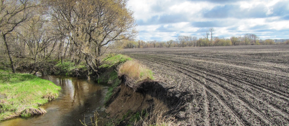
Two recently released reports (TMDL and WRAPS listed below) indicate water quality conditions in the watershed are generally poor and reflect a highly altered landscape. Nearly 70% of waterways have been converted to ditches and 88.2% of land cover has been converted from what was historically prairies and wetlands to cropland. With these and other conditions, more frequent and more intense storms that are caused by climate change are leading to larger volumes of more quickly moving — and more damaging — storm runoff. This has contributed to impairments caused by excessive levels of E. coli bacteria, elevated total suspended solids (TSS) concentrations, low dissolved oxygen, and fewer fish and aquatic insects in the Marsh River, and reduced fish communities in County Ditch 11.

Conditions stressing the reduced fish and insect communities include loss of connectivity (conditions or structures that limit movement of fish and insects), flow regime instability (unstable flows such as very high flows during spring runoff and summer rain events and little or no flow at other times), insufficient physical habitat, high suspended sediment, and low dissolved oxygen. Fortunately, the following four waterbodies in the Marsh River Watershed show they currently support healthy biological communities: sections of Judicial Ditch 51, County Ditch 45, Spring Creek, and County Ditch 66.

The reports identify areas within the watershed where implementation of BMPs would have the best results and lead to the highest pollutant reductions. These include buffer strips along streams, conservation cover, cover crops, and limiting livestock access to waterways. With the vast majority of the watershed under private ownership, restoring water quality relies on landowners’ willingness to implement BMPs in the highest priority locations.

A few examples of BMPs that have already been implemented in the MRW by local partners and landowners are nutrient management on 14,421 acres, cover crops on 7,771 acres, restoration of three wetlands totaling 180 acres, four grade stabilization structures, and a water and sediment control basin.

More information

Contact

Danielle Kvasager
Watershed project manager
218-846-8117