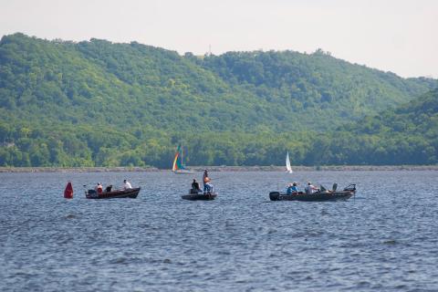
Lake Pepin is the naturally widest part of the Mississippi River, bordered by Minnesota on the west and Wisconsin on the east. It is located about 60 miles downstream of St. Paul, Minn., just south of the confluence of the St. Croix and Minnesota rivers into the Mississippi. The lake is 21 miles long, averages 1.7 miles wide and covers 29,295 acres. It has a maximum depth of 60 feet and an average depth of 18 feet.
It is a naturally occurring lake formed by the backup of water behind sedimentary deposit of the Chippewa River's delta on the Wisconsin side. It is part of Pool 4 which extends from Lock and Dam 3 near Red Wing, Minn., to Lock and Dam 4 downstream at Alma, Wis.
The towns of Maiden Rock and Stockholm border on the Wisconsin side, while Frontenac State Park takes up a large part of the Minnesota side. The largest city on the waterfront is Lake City, Minn.
About 48,634 square miles — roughly half of Minnesota’s total land area plus small portions of three neighboring states — including the Upper Mississippi, St. Croix, and Minnesota rivers, drain into the Lake Pepin. A number of small streams in southeast Minnesota, many of them coldwater trout streams, drain directly to the lake, making up the Mississippi River - Lake Pepin watershed.
Lake Pepin TMDL and site-specific standard
The MPCA assessed Lake Pepin in 2002 and found nutrient levels too high to meet state water quality standards designed to ensure that lakes and streams are fishable and swimmable. The assessment led to initiation of a Total Maximum Daily Load (TMDL) study to define the maximum amount of phosphorus that the lake can carry without violating water quality standards.
Lake Pepin is impaired by high levels of nutrients that cause excessive growth of algae. High levels of sediment, carried in by major river systems, also affect the lake. The sediment is filling in the lake at a much faster rate than before Minnesota was settled and intensely farmed. Nutrients and sediment are distinct, yet inter-related pollutants because they often share the same nonpoint sources and transport mechanisms.
The South Metro Mississippi River and Minnesota River total suspended solids (TSS) TMDLs have been approved by the U.S. Environmental Protection Agency (EPA) and describes the allowable sediment loads for the Mississippi and Minnesota Rivers, both of which drain to Lake Pepin. The South Metro project, the Minnesota River TSS TMDLs, and the Sediment Reduction Strategy are all related to the Lake Pepin TMDL in that together they describe sediment sources, transport mechanisms, and large-scale reduction strategies to reduce sediment loading. Reducing sediment will also reduce nonpoint phosphorus loading.
At the recommendation of the Lake Pepin TMDL Science Advisory Panel, the MPCA suspended the draft project report in 2010 until the MPCA developed site-specific water quality criteria for the lake:
In March 2011, the MPCA published site-specific eutrophication criteria that were adopted by the MPCA Citizens' Board in June 2014 as part of amendments to state water quality standards:
Subsequent to EPA approval of the standards, which provide “custom” water quality goals for Lake Pepin and other river pools, the MPCA has assembled all the past technical work, stakeholder input, and modeling results to arrive at a TMDL and a report that can be shared and reviewed.
Based on research, the site-specific standard for Lake Pepin consists of:
- 100 micrograms per liter for total phosphorus
- 28 micrograms per liter for chlorophyll-a
The MPCA believes these criteria will provide protection of aquatic recreational uses for Lake Pepin and the downstream pools and should be applicable over the range of flows for which the criteria were developed. For perspective, the mean level of total phosphorus in Lake Pepin from 2009-2018 was 134 micrograms per liter and the mean chlorophyll-a was 27 micrograms per liter.
Achieving the site-specific standard for Lake Pepin will mean reducing phosphorus and chlorophyll in specific upstream watersheds, such as the Lower Minnesota, Crow, and Sauk rivers. To quote the Executive Summary of the criteria document, "The proposed Lake Pepin criteria should not be used in isolation to imply that phosphorus reductions anywhere upstream of the lake will have the desired impact. The main biological activity affecting Lake Pepin trophic status is not taking place in the lake, but upstream of it."
In particular, reductions upstream of the Minneapolis-St. Paul wastewater treatment plants will be needed to achieve the desired standards. Since 2000 Minnesota wastewater facilities have achieved a collective phosphorus load reduction of about 81%.
The Lake Pepin criteria are not stand-alone goals to be pursued in isolation. Rather, they are part of the goals for the Mississippi River system, which, if pursued systematically in unison, will achieve the desired results. Accordingly, the TMDL effort has been broadened to include two river eutrophication impairment listings. Data indicate that these river sections grow too much algae and as such require phosphorus TMDLs. These TMDLs are coupled with the Lake Pepin TMDL because they share the "big river" scale and, as such, basin-wide nonpoint strategies apply to them all. Regarding point sources, the MPCA is developing individual wasteload allocations in consideration of all applicable TMDLs — Lake Pepin, river eutrophication, and local impairments.
For more information regarding river eutrophication, see the Phosphorus in wastewater webpage.
Lake Pepin is a complex ecosystem with an expansive watershed. The lake is important to the state for economic, environmental and cultural reasons. While the MPCA and partners worked to bring the TMDL study to public notice, state agencies and local partners have implemented many projects to reduce the level of nutrients in rivers that feed Lake Pepin. These projects have a rippling effect all the way to the Gulf of Mexico where high nutrient levels have created a hypoxic area or "dead zone." The Lake Pepin Legacy Alliance is pursuing project funding to remove sediment and restore in-lake habitat in upper Lake Pepin.
The Minnesota Nutrient Reduction Strategy, developed through a statewide stakeholder process and currently being updated, provides detailed discussion of phosphorus sources, transport mechanisms, reduction strategies and example scales of BMP adoption that would correspond to various milestone goal attainment. The strategy constitutes the over-arching implementation plan for the nonpoint phosphorus reductions in the Lake Pepin watershed. At the major watershed scale nutrient reduction goals are described in watershed restoration and protection strategies (WRAPS) and local water planning (One Watershed One Plan).
TMDL report
- (EPA approval 5/19/2021)
- Webex: Public meeting on the Lake Pepin and Upper Mississippi TMDL (May 6, 2020)