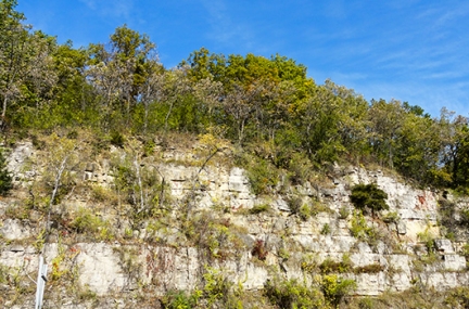
In karst landscapes, the distinction between groundwater and surface water is blurry. Groundwater may emerge as a spring, flow a short distance above ground, only to vanish in a disappearing stream, and perhaps re-emerge farther downstream again as surface water. This connection between groundwater and streams makes southeastern Minnesota home to many cold-water streams, where trout and other important species thrive. In addition, pollution affecting groundwater can quickly threaten a stream, and the animals and plants living there. And contaminated surface water can easily become groundwater pollution, and pose a health risk to those using it for drinking.
Another concern is the potential for carbonate bedrock beneath liquid storage basins to collapse, which has been reported in many states, including North Carolina, Missouri, Iowa, and Minnesota. Since 1976, municipal sewage lagoons have collapsed in three southeastern Minnesota communities (Altura, Bellechester, and Lewiston); all three were built in similar hydrogeologic settings: shallow carbonate bedrock beneath a thin layer of sand or sandstone. Geologists theorize that the lagoons’ high leakage rates saturated the sandy material beneath with carbonate-poor water, which readily dissolved the underlying carbonate bedrock, or washed soil into preexisting solution cavities. The collapsed lagoons sent millions of gallons of wastewater into the aquifer.
More information
Karst data and publications
- Root River Field to Stream Partnership
- Vulnerable groundwater area map
- Geologic controls on groundwater and surface water flow in southeastern Minnesota and its impact on nitrate concentrations in streams
Investigation to support watershed planning efforts in southeast Minnesota, specifically the geologic controls on nitrate transport in the region, including nitrate in groundwater that is the source of baseflow to streams. (Runkel, Anthony C., et al.; Minnesota Geological Survey, 2014) - Stratigraphic positions of springs in southeast Minnesota
This report and associated database summarize the results of various projects where MGS staff investigated the location and stratigraphic position of southeastern Minnesota springs. (Steenberg, Julia R; Runkel, Anthony C; Minnesota Geological Survey, 2018) - Minnesota groundwater tracing database and dye tracing studies
Information from nearly 400 groundwater traces in Minnesota, most conducted using fluorescent dyes - Drain tiles and groundwater resources: Understanding the relations
This white paper documents the state of the science for describing, understanding, and quantifying the relation of subsurface drainage (drain tiling) to groundwater resources. (Minnesota Ground Water Association, 2018)
Technical resources
Pollution prevention is the best strategy for protecting water quality in the karst region. Learn more through these technical resources:
- Stormwater BMPs for Karst areas
- Minnesota Geological Survey
- Springs, Springsheds, and Karst (MN Dept. of Natural Resources)
- Groundwater Protection Rule (MN Dept. of Ag)
- Southeast Minnesota groundwater resources (MN Dept. of Ag)
- Minnesota Geospatial Commons: Karst and Spring Inventory and Bedrock Sensitivity Maps
- Minnesota Groundwater Association