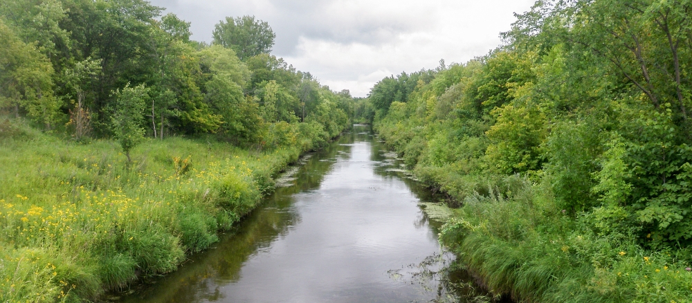
The Clearwater River Watershed drains an area of 886,600 acres in the Red River of the North basin. The Clearwater River begins its course in western Clearwater County near the town of Ebro. The river flows to the northwest and southwest, eventually emptying into Red Lake River near Red Lake Falls. The watershed occurs in the Glacial Lake Agassiz Plain, North Central Hardwoods, Northern Lakes and Forests, and Northern Minnesota Wetlands Level III Ecoregions.
The Clearwater River watershed characteristically has a poorly defined floodplain and low gradient that combine with extensive drainage, widespread conversion of tallgrass prairie to farmland, and urban/suburban development to leave the basin subject to frequent floods that affect urban and rural infrastructure and agricultural production. Precipitation in the watershed ranges from 21 to 25 inches annually. Above-normal amounts of precipitation in the late fall of the year or from May to October lead to high levels of soil moisture, periodically producing the snow-melt and summer floods that are known to affect the further reaches of the overall Red River Basin.
Predominate land uses/land covers are row crops (33%), forest (24%), grass/pasture/hay (21%), wetlands (14%), and residential/commercial Development (4%). Agricultural land use in the basin accounts for approximately 54% of the overall watershed acres. Development pressure is moderate in most areas, with occasional farms, timberland, and lakeshore being parceled out for recreation, lake or country homes.
The main resource concerns in the watershed are wind and water erosion, nutrient management, wetland management, surface water quality, flood damage reduction, and wildlife habitat. Many of the resource concerns relate directly to flooding and increased sediment and pollutant loadings to surface waters.
Data gathered from the Clearwater River Watershed and documented in the watershed's total maximum daily load (TMDL) and watershed restoration and protection strategy (WRAPS) reports reflect similar findings recorded in ten years’ worth of in-depth studies conducted throughout the broader Red River Basin. A TMDL report determines the levels of pollutants that water bodies can receive and still meet water-quality standards. WRAPS reports recommend steps for restoring waters that don’t meet standards and protecting waters that are in good condition.
The reports are part of the MPCA’s approach to gauging the health of Minnesota’s 80 major watersheds and will inform projects by local, regional, and even international partners to restore and protect lakes and streams.
The Clearwater River Watershed TMDL and WRAPS reports (see links below) describe excess sediment and degraded habitat for fish and aquatic insects, and 15 stream segments with recreational safety concerns due to high levels of E. coli bacteria. Barriers to fish passage such as improperly installed or sized culverts are also causing impairments to aquatic communities. Too many nutrients are causing algal blooms in lakes.
The Clearwater River Watershed falls within the Red Lake Watershed District (RLWD), a primary author of both reports. The RLWD and its partners (including soil and water conservation districts and landowners) have completed many projects and assisted in implementing strategies to improve or protect water quality for several years. For example, many wild rice farmers have adopted a different approach to draining wild rice paddies, changing from surface drainage to main-line tile drainage to reduce sediment in drainage water after harvest. Protection strategies for a trout stream reach of the upper Clearwater River include repairing damaged riparian areas to keep the stream healthy. Trout streams are not common in the Red River Basin and this reach is at risk for becoming impaired by E. coli.
Many water-quality issues are linked to artificial drainage and stream alterations. These human-made changes have led to inconsistent stream flows — high flows during spring runoff and summer rains, and low flows in much of the rest of the year — which damage aquatic habitat and contribute to erosion. Climate change is bringing more frequent and intense storms that also adds to runoff.