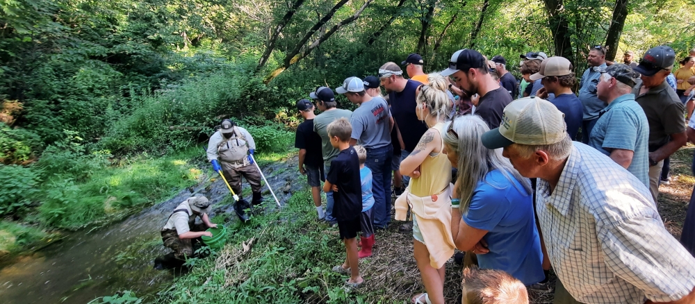
Every summer, MPCA scientists don waders to enter lakes, rivers, and streams across the state, thermometers and buckets in hand to measure water temperature and clarity. They count bugs and fish. They test for chemical pollutants and sediment. As they do so, they aren't just tracking the health of watersheds. They're also preparing a cleaner future for Minnesota's waters.
That's because once the scientists pack up their equipment and put the waders away, they take everything they learned in those lakes, rivers, and streams and apply it to reports specific to each of the state's 80 watersheds — reports that outline the steps conservationists need to take to improve water quality.
Those watershed restoration and protection strategy reports — often called WRAPS reports — suggest improved practices in agriculture, forestry, and urban planning. For agriculture, this could mean encouraging crop rotation, cover crops, and buffer strips that reduce runoff. In urban areas, it could mean green infrastructure such as rain gardens and permeable pavement that help manage stormwater. The MPCA also supports community outreach programs to educate local stakeholders about the impact of their actions on watershed health, fostering a culture of stewardship.
The agency passed a milestone in June 2023 when it published its 80th WRAPS report, covering every watershed in the state for the first time. The process started in 2008 with monitoring of the Little Fork River Watershed in northeastern Minnesota and ended with the Blue Earth River Watershed, an area of flat prairies around Mankato. Minnesota’s Clean Water Fund, which allocates a portion of sales taxes to ensure Minnesota's waters are clean for future generations, makes the research that goes into these WRAPS reports possible.
The agency’s scientists have now started circling back to some of the first evaluated watersheds to see what has changed in the intervening years. Conditions in some parts of those watersheds have improved while in others the scientists have found pollution that hurts fish, bugs, or people. Here’s a look at the four watersheds for which MPCA scientists published updated data in 2024.
Root River (April)
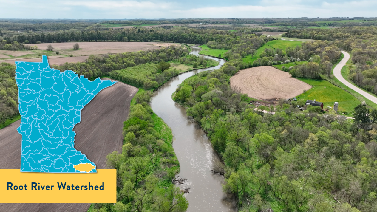
Pollution of groundwater used as drinking water is a long-standing problem in the Root River Watershed. This area in the southeast corner of the state includes parts of Mower, Olmsted, Fillmore, Winona, and Houston counties. Nearly half of the land is used for agriculture (48%), and the geology includes karst limestone, which lets water pass through easily. That’s why pollutants on the land can easily reach the groundwater.
Water quality has not changed significantly since the MPCA first collected data in 2008. Five stream segments saw improved conditions and were removed from Minnesota’s impaired waters list while 26 stream segments were added for not meeting water quality standards. Changes in water flow have hurt water quality and are part of plans for improvement.
Winona State University is mapping the area’s water basins, pond dams, strip cropping, buffer strips, and other structures that affect water flow. The Root River Field to Stream Partnership is an effort by multiple agencies to evaluate agricultural practices.
The MPCA developed some tools to help local partners manage the watershed. An online mapping tool helps identify the best locations for restoration work. A fact sheet identified feedlot locations that could be considered by county officials during inspections.
- (MPCA approval 4/23/24)
Mississippi River-St. Cloud (June)
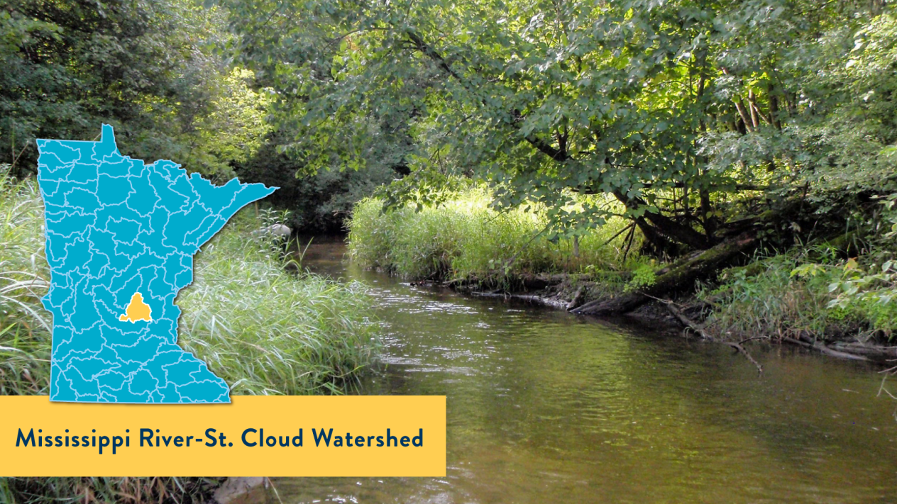
Overall, significant progress in surface water quality has occurred within the Mississippi River-St. Cloud Watershed over the past decade. This area in the south-central part of the Upper Mississippi River Basin includes Benton, Meeker, Mille Lacs, Morrison, Sherburne, Stearns, and Wright counties. Agriculture land use is at 40%, mostly cultivated corn and soybeans. The watershed includes St. Cloud, the first city along the Mississippi River to obtain its drinking water from this resource.
The MPCA recorded improvements in aquatic life communities and improved water quality on 17 lakes. In the past decade, the agency has removed eight bodies of water from the impaired waters list, two of which are featured as success stories on the U.S. Environmental Protection Agency’s website: Plum Creek, which had better levels of bacteria; and Lake George, which had better levels of nutrients.
However, ongoing challenges, such as excess nutrients, elevated levels of bacteria, and low dissolved oxygen levels, continue to exist. Also, the watershed is on the fringe of the Twin Cities metro area and continues to see loss of shoreland habitat as communities continue to grow. It has some of the state’s fastest growing communities in or near it, including Otsego, Dayton, Rogers, and Sartell.
- (MPCA approval 6/20/2024)
Pomme de Terre River (August)
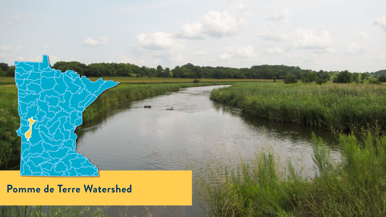
At its start, the Pomme de Terre River is cool and clear and runs through wooded hills and grassy meadows. As it nears its mouth, the river is bordered by eroding banks and becomes increasingly muddy before discharging into the Minnesota River. This watershed in west-central Minnesota is mostly rural. It includes areas of Otter Tail, Grant, Douglas, Stevens, Big Stone, and Swift counties. Land use is about 69% agricultural.
Researchers added five lakes and eight segments of streams to the impaired waters list and removed one stream segment on Pelican Creek, where living conditions for bugs has improved. Watershed-wide, total phosphorus and sediment need to be reduced considerably to meet water quality standards. E. coli needs to be reduced by 40% to 90% for large portions of the watershed. Increasing water flows are creating steeper stream channels and contributing more sediment to the river.
Some improvements were found, too. Trends show 29% of lakes with long-term data have better water clarity than they did 10 years ago. To further improve conditions, implementation of agricultural best management practices will help lower the levels of total phosphorus and sediment.
- (MPCA approval 8/8/2024)
Mississippi River-Lake Pepin Tributaries (November)
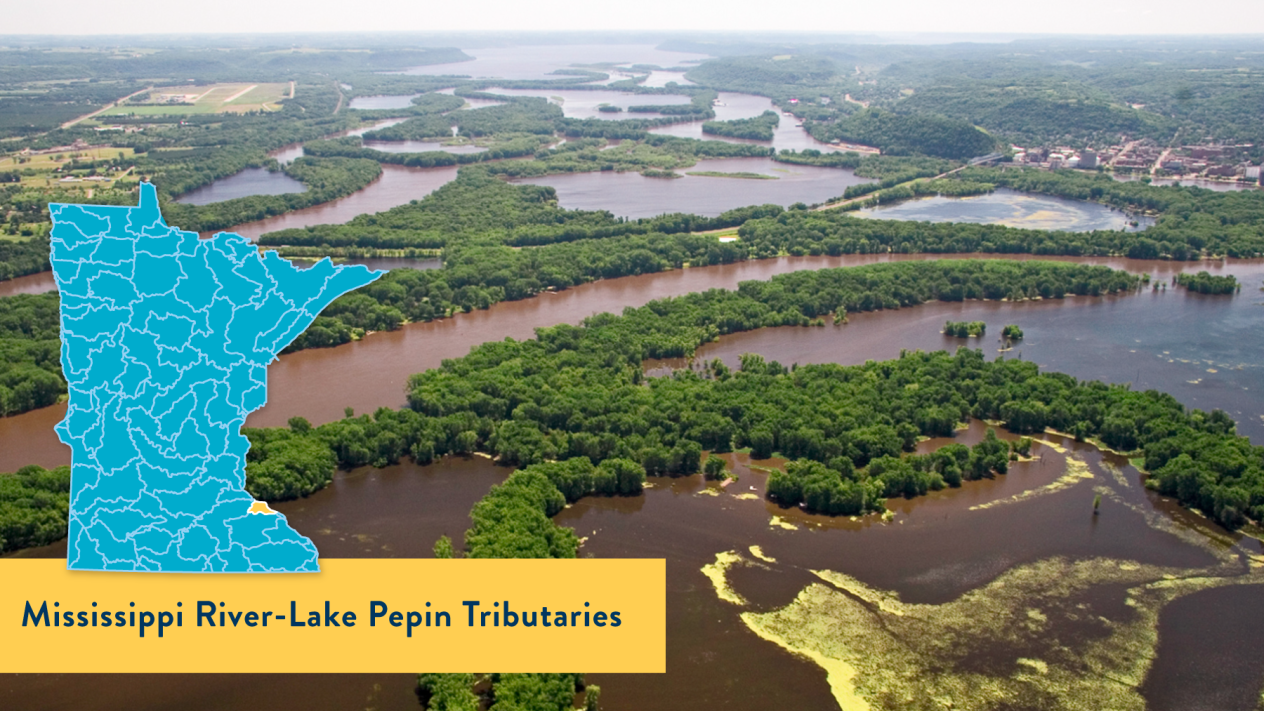
This watershed has such a long name because it’s actually a smaller part of the Mississippi River-Lake Pepin Watershed. Add “tributaries” to that name, and you’re looking at an area with six main coldwater streams that drain into the lake. Five of them are designated trout streams. The area is in southeast Minnesota, south of Red Wing, and includes Goodhue and Wabasha counties. It features karst topography and bluffs that allow water to quickly move from the surface to underground. Agriculture accounts for 63% of the land use.
New data show that, overall, conditions in the watershed are improving. There are more trout and a more diverse bug population than 10 years ago. The MPCA added Wells Creek to the impaired waters list for total suspended solids but removed two others: Hay Creek, which improved for water clarity, and Gilbert Creek, which saw improvements in its fish population.
Excess sediment is a pervasive problem. Many native prairies have been converted to row crop agriculture, leading to erosion. The new report explains how sediment reduces sunlight for plants and prevents fish from seeing their food. Restoration work can make a difference with these problems.
Habitat improvement work on Hay Creek lowered high stream banks and reconnected the stream to the flood plain. Strategies used in other projects included grassed waterways, water and sediment control basins, terraces, habitat improvement, cover crops, and reduced and no-till practices. The watershed is a good example of how private landowners, local government, and state agencies can work together.
- MPCA approval 11/9/2024