The Chippewa River Watershed in west-central Minnesota drains 2,080 square miles (1.3 million acres) of the Minnesota River Basin across eight counties: Swift, Pope, Kandiyohi, Douglas, Stevens, Grant, Otter Tail, and Chippewa. Originating in northeast Douglas County, the Chippewa River flows approximately 130 miles southwest to Montevideo, where it joins the Minnesota River.
As a key component of the Upper Minnesota River Basin, the health of this rural watershed is vital to both local communities and the broader river system. It features a diverse landscape of streams, lakes, and wetlands that support agriculture, wildlife, and recreation.
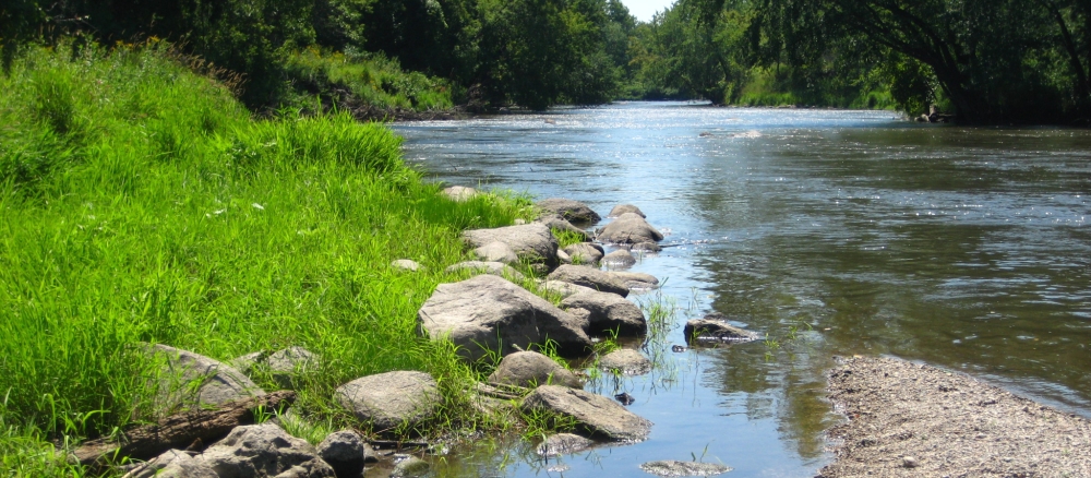
The watershed’s terrain includes rolling hills, glacial deposits, lakebed soils, and sandy outwash plains. The northeastern hills are more wooded and prone to erosion, contributing sediment to nearby streams. In contrast, the flatter southwestern region is dominated by agriculture. Nearly 90% of the land is privately owned, while less than 10% remains as forest, wetland, or native grassland. Urban development is limited but slowly expanding near some towns.
Historically, the landscape has undergone dramatic transformation. Since European settlement, the landscape has largely been converted from native prairie, wetlands, and forests to agricultural use. By the late 20th century, more than 85% of the watershed was used for farming, primarily for row crops such as corn and soybeans, with a decline in small grains, pasture, and hay. This transformation included extensive ditching, tile drainage, and wetland loss, which reduced natural water storage and increased surface runoff. Urban development in the watershed is limited but increasing near some towns, and many lakes face stress from lakeshore development.
Monitoring and assessment
Strategy development for restoration and protection
- (EPA approval of 2/25/2026)
- (EPA approval 6/7/2017)
- (MPCA approval 2/13/2026)
- (MPCA approval 3/16/2017)
Additional TMDL projects
- (EPA approval 3/1/2017)
- (EPA approval 10/29/2004)
- (EPA approval 1/11/2007)
- (MPCA approval 3/10/2016)
- (EPA approval 9/29/2014)