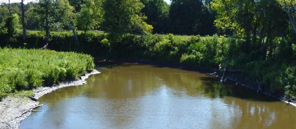
The Snake River begins its 50-mile course in Marshall County and drains an area of 611,800 acres. The river flows southwest from the headwaters, continuing westward and collecting the South Fork Snake River and passing through the towns of Warren and Alvarado. Downstream of Alvarado, the Snake turns northwest, then collects the Middle River upstream of its confluence with the Red in Fork Township.
The Snake River Watershed lies within Marshall, Polk, and Pennington Counties in NW Minnesota. The Snake River originates approximately six miles west of Newfolden where it flows southwest collecting the Snake River South Branch and passes through the towns of Warren and Alvarado. Downstream of Alvarado, the river turns northwest and collects the Middle River approximately five miles upstream of its confluence with the Red River. The watershed drains approximately 611,800 acres.
The Red River basin generally has a poorly defined floodplain and low gradient that combine with extensive drainage, and widespread conversion of tallgrass prairie to farmland (84% of the overall watershed acres) to leave many areas subject to frequent floods. Streams in the watershed have very "flashy" flows: high-flow levels during spring melt and summer rain events, and low-flow, stagnant conditions later in the summer and fall. This in turn creates conditions that negatively impact fish and aquatic insect communities: insufficient physical habitat, high levels of suspended sediment, and low dissolved oxygen. Other concerns in the watershed are wind and water erosion, nutrient management, wetland management, surface water quality, flood damage reduction, and wildlife habitat.
Other than farming, development pressure in the watershed is low. Occasionally land may be parceled out for hunting.
The Snake-Middle Rivers Watershed (SMRW) watershed approach process began in 2013 with intensive monitoring. Thirty-four stream sites were sampled for biology at the outlets of various subwatersheds and the headwaters of smaller streams. In 2015, a holistic approach was taken to assess surface waterbodies for support or non-support of three beneficial uses: aquatic life (fish, aquatic insects), aquatic recreation (direct contact with water such as swimming) and aquatic consumption (human consumption of fish).
There are a total of 31 impairments on the EPA-approved 2018 impaired waters list (three for E. coli five for turbidity, seven for dissolved oxygen (DO), and 16 biological impairments). All of these impairments are addressed in a Watershed Restoration and Protection Strategy (WRAPS) report.
A total maximum daily load (TMDL) report was done that includes studies that address eight of the 31 impairments: three river/stream-reach aquatic recreation use impairments caused by elevated Escherichia coli (E. coli) levels and five river/stream-reach aquatic life use impairments caused by turbidity, or too much suspended solids in the water (soil particles, etc.).
The goal of a TMDL is to quantify how much of a pollutant can enter a waterbody and still meet state water quality standards. The remaining 23 impairments were not addressed with TMDL studies for various reasons such as lack of information and lack of reasonable assurance that the TMDL reductions could be met.
Numerous restoration and protection strategies, or best management practices (BMPs), have been developed through collaboration with local and state partners. Strategies are largely focused on addressing sediment and phosphorus loading and altered hydrology, and they range from small-scale, agronomic practices such as nutrient management and cover crops to larger, engineered solutions such as stream restoration, wetland restoration, or impoundments. Addressing runoff, erosion, and altered hydrology will be key to restoring habitat by increasing dissolved oxygen concentrations and providing more suitable in-stream habitat. A sediment source study was funded by the MPCA to identify potential high-priority areas deserving further study.
Monitoring and assessment
Strategy development for restoration and protection
- (EPA approval 12/21/2020)
- (MPCA approval 12/3/2020)