The Rainy River - Rainy Lake Watershed is an international watershed located in the Rainy Basin, east of International Falls, Minnesota. This watershed is widely known for the recreational opportunities Rainy Lake and the surrounding wilderness areas provide. There are no large cities in this remote watershed. The small communities of Island View, Ericsburg, Ray, and Rainer are the only towns in the Minnesota portion watershed. The watershed covers 296,624 acres and is located in the Laurentian Mixed Forest Ecological Province. Lakes and wetland areas make up 54% of the Minnesota portion of the watershed. The Minnesota portion of the watershed is 67% in Koochiching County and 33% in St. Louis County.
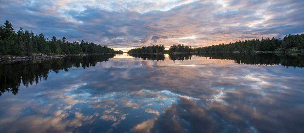
The eastern two-thirds of massive Rainy Lake is part of the border lakes in Voyageurs National Park (VNP). Rainy Lake provides spectacular, undeveloped scenery, dotted with islands. Motor boats and other watercraft are allowed within the park and are the only practical means of entering this unique national park. Winter access is by snowmobile, dog sled or skis.
This area is primarily boreal forest on shallow soils over bedrock or peat bog. The eastern portion is in the Border Lakes ecological sub-region; the western portion is in the Little Fork/Vermilion Uplands interlaced with extensive wetland bogs. Wilderness recreation/tourism is the prime economic driver due to the scenic beauty, resorts, camping, fishing, and hunting opportunities. Logging also occurs outside of the VNP.
The undeveloped nature of the watershed provides protection to surface waters and this is reflected in the good water quality found within its lakes and streams. Rainy Lake fully meets recreational water quality standards and most Rat Root River and East branch stream miles are in good condition. However, in some parts of the watershed TSS and DO occasionally fail to meet state standards. The region's geologic past left behind flat topography and fine sediment, a legacy which likely plays a significant role in the poor total suspended solids and dissolved oxygen water quality readings.
Increases in environmental stress caused by human activity, such as historical and recent forest cover changes, flow alterations, and the draining of wetlands, may locally affect aquatic life health (fish and aquatic insect communities). Where standards are being met, protection strategies to maintain good water quality are important.
Monitoring and assessment
The Rainy River Basin Plan, which included this watershed, was published in 2004 in partnership with local, county and other state agencies. Significant and successful collaborative efforts have been made with Canadian resource agencies and the International Joint Commission to manage the Rainy River Basin waters on both sides of the border. All the major lakes in this watershed have a fish consumption advisory for mercury levels. Intensive watershed monitoring started on this watershed in 2016.