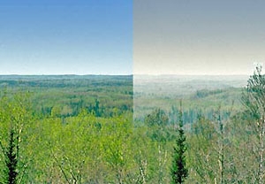
One of the most basic forms of air pollution, haze, reduces visibility in many cities and scenic areas within the United States. Haze is caused when sunlight encounters tiny particles of air pollution. Some light is absorbed by these particles; other light is scattered away before it reaches an observer. More pollution means more absorption and scattering of light, which reduces the clarity and color of what we see. Haze-causing pollutants come from a variety of sources, both natural and man-made, including motor vehicles, electricity generation, industrial facilities, agriculture, and wildfires.
In amendments to the Clean Air Act in 1977, Congress added Section 169 (42 U.S. Code § 7491), setting forth a national visibility goal of restoring pristine conditions in national parks and wilderness areas. These areas were designated as Class I areas.
To achieve the national visibility goals mandated by Congress, in 1999 the U.S. Environmental Protection Agency (U.S. EPA) established a regulatory program called the Regional Haze Rule under the Clean Air Act. This program created regulations designed to improve visibility in our nation's national parks and wildernesses (Class I areas) and restore them to natural visibility conditions by 2064. The Regional Haze Rule is found in 40 CFR § 51.308 and covers over 150 Class I areas in the United States.
What are Minnesota’s Class I areas?
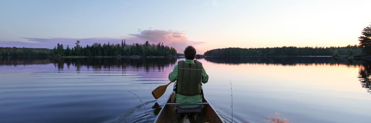
Minnesota has two Class I areas within its borders: the Boundary Waters Canoe Area Wilderness (BWCA) and Voyageurs National Park. Other nearby Class I areas include Isle Royale National Park in Michigan.
What does regional haze mean for Minnesota?
States are responsible for developing a Regional Haze State Implementation Plan (SIP) that addresses regional haze in each Class I area located within the state and in each Class I area located outside the state which may be affected by emissions from sources within the state. The Regional Haze SIP is required to identify existing facilities that cause or contribute to visibility impairment; analyze, identify, and apply federally enforceable control strategies for those sources; and periodically demonstrate reasonable progress toward reaching visibility goals. States are also responsible for periodic comprehensive updates to their Regional Haze SIPs that address these same topics.
In between comprehensive updates, states are responsible for providing interim progress reports that outline the status of required Regional Haze SIP elements. These progress reports are generally due every five years after a state submits its SIP. The progress reports evaluate how the state is moving toward the visibility goals for each Class I area to assess whether or not changes to the state’s Regional Haze SIP are needed to achieve these goals.
Improving visibility at our most pristine places
During the development of Minnesota’s initial SIP, the MPCA determined that emissions sources within the state have or may have impacts both on the Class I areas within Minnesota and on the Class I area in Michigan. As a result, the MPCA submitted Minnesota’s initial Regional Haze SIP to fulfill the requirements of the Regional Haze Rule and help reduce visibility impairment in these Class I areas.
The regional haze interim progress goals are set separately for each location. Monitoring data shows both BWCA and Voyageurs National Park have achieved the 2018 interim progress goals toward natural visibility conditions.
In addition, improved visibility and the removal of haze-causing pollution from the atmosphere in order to promote increased visibility in Class I areas will result in environmental and economic benefits and improved health for Minnesota residents and those in areas downwind of Minnesota.

This photo shows the view from the Boundary Waters Canoe Area Wilderness visibility monitor. The left side illustrates visibility conditions on average for the 20 percent best days. The right side shows what the view looks like on average on the 20 percent worst days in BWCA as a result of higher levels of fine particles.
