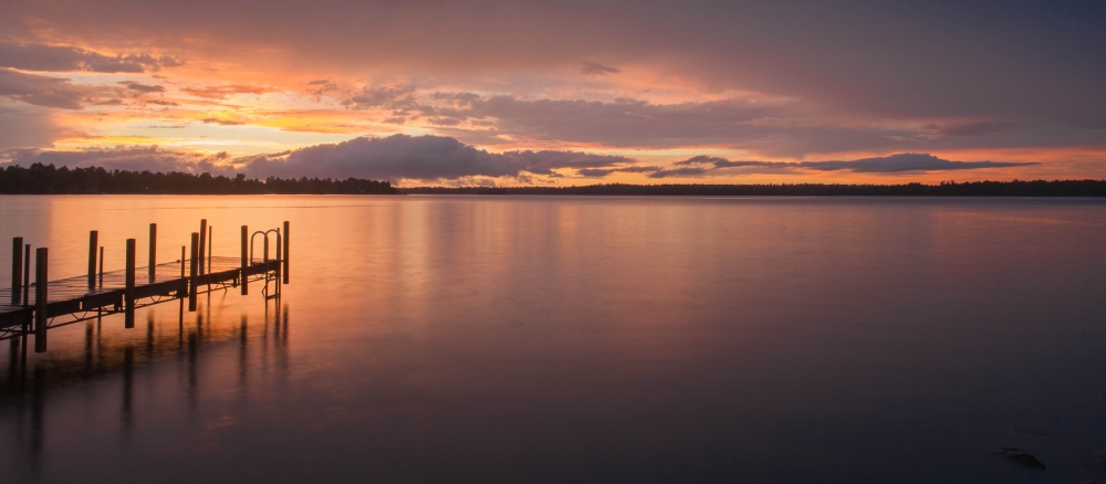
The Vermilion River Watershed, located within northern St. Louis County, covers 662,427 acres, or 1,035 square miles. The watershed’s upper two-thirds are in the Border Lakes ecological sub-region and the lower third is in the Laurentian Uplands. It contains 565 lakes covering 82,836 acres and 84,333 acres of wetlands. Headwaters include Armstrong Lake and Armstrong River east of Lake Vermilion. The Eagles Nest Lakes 1, 2, 3 and 4 are just south of Armstrong Lake; the East Two Rivers drains them into Lake Vermilion's Pike Bay. The Pike River starts between Gilbert and Virginia, Minnesota and flows 26 miles north to Pike Bay. Sand River, six miles north of Virginia, is a major tributary of the Pike River. The Vermilion River flows north from Lake Vermilion through remote forested country to Crane Lake, which abuts Voyageurs National Park, and then drains into the park and Sand Point Lake (a border water with Canada). The major lakes and streams north of Lake Vermilion are Elbow, Pelican, Moose, Myrtle, Elephant and Echo Lakes and the Pelican and Echo Rivers. They all culminate at Crane Lake.
There are no large cities in this remote watershed; the most populated are Tower (496 residents) and Orr (282). The total watershed population is 14,423 — just 14 people per square mile.
The Vermilion River Watershed includes a portion of the Boundary Water Canoe Area Wilderness near Big Trout Lake. The BWCAW is roadless, undeveloped country that is interconnected with lakes, rivers and portages. Lake Vermillion covers 39,271 acres and contains 365 islands. Its lakeshore features many cabins, homes, resorts and a casino. Recreation tourism is a prime economic driver; others include the forest industry, mining, and some farming.
Land on Lake Vermilion’s southeastern shores was purchased in 2010 for $18 million by the state of Minnesota from U.S. Steel. The land is Minnesota’s newest state park.
Lakes and streams in the watersheds bordering the Boundary Waters Canoe Area in northern Minnesota offer some of the most pristine water quality in the state. Protection strategies such as forestland conservation, protective shoreline buffers, proper culvert installation, and septic system maintenance will be crucial to maintaining their healthy conditions, according to two recent reports (shown below). Excellent water quality in the Vermilion River and Rainy River - Headwaters watersheds is attributable to the forests and wetlands that dominate the area. They absorb and filter precipitation, resulting in far less runoff carrying pollutants into lakes and streams.
“The rivers and lakes in these watersheds are some of the cleanest waters in the state,” says Katrina Kessler, MPCA assistant commissioner for water policy and agriculture. “That’s why it’s so important that we focus not only on restoring waters that don’t meet water quality standards, but also protecting lakes and streams from becoming impaired in the first place. That’s especially true for areas like the Boundary Waters that are enjoyed and treasured by so many residents and visitors.”
The MPCA and local partners found that the vast majority of streams in the two watersheds meet water quality standards designed to protect fish and other aquatic life; nearly all lakes meet standards for swimming and other recreation. Only a few waters failed to meet water quality standards.
In the Vermilion River Watershed, the MPCA assessed the health of fish and bugs in 21 stream sections and only one failed to meet the standard. Staff also assessed nine streams and 32 lakes to determine whether they’re suitable for recreation. All the streams and most of the lakes met the applicable standards. Two lakes did not meet the standard for recreation, one due to natural conditions and the other, Myrtle Lake, due to excess phosphorus that is causing nuisance algae blooms.
With minimal water quality problems, the WRAPS reports focuses on protection strategies. A core team representing local, state, Tribal, and federal agencies met to guide assessments, investigate problems, and develop strategies to protect surface water for drinking, swimming, and aquatic life and discuss ways to ensure the watershed remains pristine. Local water managers, such as North Saint Louis SWCD, are particularly focused on managing lakeshore development that could degrade the currently healthy conditions. Healthy buffers and septic system maintenance can be implemented in these localized areas of shoreline development. Focus is on waters with degrading water quality and waters nearly impaired.
Monitoring and assessment
Supporting reports
Strategy development for restoration and protection
- (EPA approval 2/04/2022)
- (MPCA approval 1/20/2022)