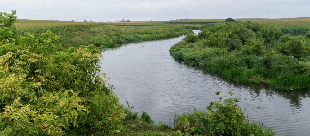
http://www.pca.state.mn.us/

Show All
Navigation
tinyURL link : 2809 Home   >   Water   >   Water Types and Programs   >   Watersheds

main content

Upper Big Sioux River Watershed

Overview


[[photo_credit]]

Watershed at-a-glance

Only a very small portion of the 1,352,428-acre Upper Big Sioux River watershed is located in Lincoln County in western Minnesota. The vast majority is located in eastern South Dakota.


Hydrologic Unit Code (HUC) 10170202 [More Info]

Intensive monitoring start year 2011 [More Info]

Major lakes Major rivers and streams

There are no lakes in the Minnesota portion of this watershed.

Medary Creek


Characteristics

Land use in this watershed is primarily agriculture, with row crops and livestock grazing.

What's being done

Starting in 2011, the Upper Big Sioux River watershed, along with three adjacent major watersheds located in the Missouri River Basin, will be starting the MPCA’s Major Watershed Restoration and Protection Project (MWRPP) process. Data collection, assessment, and implementation will occur over 10 years.

Each project begins with intensive monitoring where biological data is collected along with physical and chemical data of streams and lakes in selected watersheds. There are 138 proposed stream sites to be sampled for biological data, 23 stream sites for water quality and one site for fish tissue.

MPCA's watershed approach: Since 2007, the MPCA and its partners have begun implementing a 10-year rotation for watershed restoration plans to address Minnesota's waters at the major watershed level.

[+] See large map


Watershed News

Minnesota water stories

In communities throughout Minnesota, MPCA staff, along with other government agencies and citizen groups, are working to protect and restore the water quality of our rivers, lakes, and streams. Learn more about these efforts.

Preventing runoff

Find out how keep our lakes and rivers clean by capturing rainwater in your yard.

WaterFront Bulletin

WaterFront Bulletin: Find out about updates on impaired waters, watershed project funding, and water restoration and protection activities underway throughout the state.


Restoration and protection

The restoration and protection process

The MPCA and partner organizations evaluate water conditions, establish improvement goals and priorities, and take actions designed to restore or protect water quality on a 10-year cycle.


  Monitoring and assessment

Projects in this watershed to test water quality conditions and determine whether our lakes, rivers, and wetlands are meeting state water quality standards. [More info]

Project Name Status    
Missouri River Basin Data Collection and Outreach


Data available for this watershed

Lakes and stream segments with condition and monitoring information
Lakes and streams are divided into "assessment units" for monitoring.

Impairments in this watershed listed by lake or stream segment
Generally, a waterbody has an impairment when it exceeds a particular pollutant standard.


  Strategy development projects

Projects in this watershed that establish federal- or state-required plans for restoring water quality for impaired waters, or protecting high-quality waters. [More info]

Project Name Status    
Missouri River Basin WRAP Strategy


  Implementation activities

Projects in this watershed to put water restoration or protection measures in place, ranging from best management practices to reduce runoff from fields or streets, to fixes to wastewater treatment facilities, to education activities for citizens and landowners. Implementation projects are supported by local, state and federal government sources, including Minnesota's new Clean Water Fund.

Our partners in the watershed are continually involved in these kinds of activities. See Contacts tab.

Water data tools

Search for your lake or stream's assessment data
See information about your local lake or stream.

DNR Lake Finder
Find information about 4500+ lakes, rivers, and streams

Search MPCA surface water data
Use this tool for accessing and comparing data in all surface waters.


Contacts

Kelli Nerem, MPCA project manager

507-476-4251
This e-mail address is being protected from spambots. You need JavaScript enabled to view it.

Nobles Soil and Water Conservation District (SWCD)

507-376-9150


Maps

Watershed Map

Many of Minnesota’s lakes and streams do not currently meet water-quality standards because of pollution such as excess sediment or nutrients, bacteria or mercury. These waters are considered “impaired.” For more information, visit the impaired waters page.

The toggles show impaired waters and monitoring stations. Click on a site for more information.

Impairments in this watershed, listed by lake or stream segment Generally, a waterbody has an impairment when it exceeds a particular pollutant standard.


Last modified on Monday, November 28, 2011 14:56

additional content