http://www.pca.state.mn.us

tinyURL : enzqe13 | ID : 2829Home   >   Water   >   Water Types and Programs   >   Watersheds

main content

Roseau River Watershed

Overview

[[photo_credit]]

Watershed at-a-glance

The Minnesota portion of the Roseau River watershed covers 774,197 acres. There are an additional 594,560 acres occurring across the U.S. border in Canada. The watershed is situated in two ecoregions. All but a relatively small part of the central portion of the watershed lies in the Northern Minnesota Wetlands ecoregion, and the central portion of the watershed is located in the Red River Valley ecoregion.

According to the Minnesota Pollution Control Agency, the watershed is the most severely impacted by flooding in the Red River Basin. Annual average flood damage (in 1996 dollars) in the watershed was estimated at nearly $4.9 million with 92% of the damage being rural. The watershed suffers 24% of flood damages occurring in the Red River Basin, outside of damages occurring along the main stem of the Red River.


Hydrologic Unit Code (HUC) 09020314 [More Info]

Intensive monitoring start year 2015 [More Info]

Major lakesMajor rivers and streams

Roseau Lake

Roseau River


Characteristics

Resource concerns include improved drainage for crop production, grazing management of forest and grassland, water/wind erosion, and water quality impacts. Additional resource concerns include management of flooding, short growing season, and pasture management.

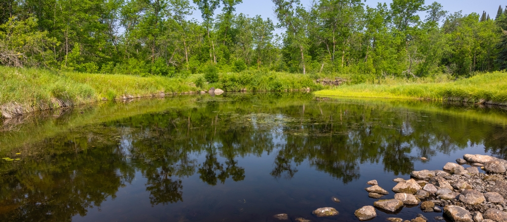
The entire watershed was once covered by Glacial Lake Agassiz. When the lake receded, it left behind a level plain containing beach ridges and remnant lakes. Elevation in the watershed is approximately 1,250 feet at the headwaters, and about 780 feet at the mouth of the Roseau River. A buried aquifer underlies an area along the Roseau River in the northeastern portion of the watershed.

The majority of land within this watershed is not highly erodible, and is well to moderately well suited to agricultural uses. Agricultural land use in the basin accounts for slightly less than 50% of the watershed’s acres. Wetlands  make up another 43%.

What's being done

Intensive watershed water quality monitoring and a major watershed restoration and protection project are scheduled for 2015.

MPCA's watershed approach: Since 2007, the MPCA and its partners have begun implementing a 10-year rotation for watershed restoration plans to address Minnesota's waters at the major watershed level.

[+] See large map


Watershed News

Is Minnesota's water quality important to you?

If so, take this quick survey. Less than 5 minutes of your time will help us give you the information you want about Minnesota's water quality.

Minnesota water stories

In communities throughout Minnesota, MPCA staff, along with other government agencies and citizen groups, are working to protect and restore the water quality of our rivers, lakes, and streams. Learn more about these efforts.

Preventing runoff

Find out how keep our lakes and rivers clean by capturing rainwater in your yard.

WaterFront Bulletin

WaterFront Bulletin: Find out about updates on impaired waters, watershed project funding, and water restoration and protection activities underway throughout the state.


Restoration and protection

The restoration and protection process

The MPCA and partner organizations evaluate water conditions, establish improvement goals and priorities, and take actions designed to restore or protect water quality on a 10-year cycle.


  Monitoring and assessment

Projects in this watershed to test water quality conditions and determine whether our lakes, rivers, and wetlands are meeting state water quality standards. [More info]

Project Name Status    
Red River Basin Condition Monitoring Network
Red River Basin River Watch Project
Red River Basin Stream Monitoring & Assessment
Red River Watershed Management Board
Roseau SWCD River Monitoring


Data available for this watershed


Lakes and stream segments with condition and monitoring information
Lakes and streams are divided into "assessment units" for monitoring.

Impairments in this watershed listed by lake or stream segment
Generally, a waterbody has an impairment when it exceeds a particular pollutant standard.


  Strategy development projects

Projects in this watershed that establish federal- or state-required plans for restoring water quality for impaired waters, or protecting high-quality waters. [More info]

Project Name Status    
Mercury Pollutant Reduction Plan
Roseau River Major Watershed WRAP Strategy


  Implementation activities

Projects in this watershed to put water restoration or protection measures in place, ranging from best management practices to reduce runoff from fields or streets, to fixes to wastewater treatment facilities, to education activities for citizens and landowners. Implementation projects are supported by local, state and federal government sources, including Minnesota's new Clean Water Fund.

Our partners in the watershed are continually involved in these kinds of activities. See Contacts tab.

Water data tools

Search for your lake or stream's assessment data
See information about your local lake or stream.


DNR Lake Finder
Find information about 4500+ lakes, rivers, and streams


Search MPCA surface water data
Use this tool for accessing and comparing data in all surface waters.


Contacts

Cary Hernandez, MPCA project manager
218-846-8124
Cary.Hernandez@state.mn.us


Maps

Watershed Map

Many of Minnesota’s lakes and streams do not currently meet water-quality standards because of pollution such as excess sediment or nutrients, bacteria or mercury. These waters are considered “impaired.” For more information, visit the impaired waters page.

The toggles show impaired waters and monitoring stations. Click on a site for more information.

Impairments in this watershed, listed by lake or stream segment
Generally, a waterbody has an impairment when it exceeds a particular pollutant standard.


Last modified on November 28, 2011 13:50

additional content