Rock River Watershed
Overview
Watershed at-a-glance
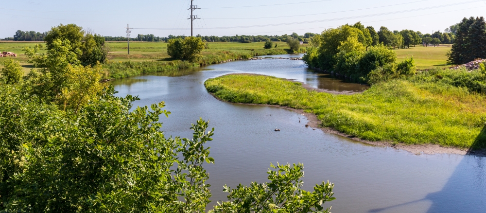
The Rock River watershed covers 1,075,032 acres in Rock, Nobles, Pipestone, and Murray counties in southwestern Minnesota. It is the largest of the four watersheds in Minnesota that are part of the Missouri River Basin, extending south into Iowa.
| Hydrologic Unit Code (HUC) | 10170204 | [More Info] |
| Intensive monitoring start year | 2011 | [More Info] |
| Major lakes | Major rivers and streams |
|---|---|
|
There are no major lakes in this watershed. |
Rock, Little Rock, Kanaranzi Creek |
Characteristics
Land use in this watershed is primarily agriculture, with most land in row crop production. Pastureland is also prevalent throughout the watershed. There are no natural lakes in this watershed. Some of the larger communities in the watershed are Luverne, Adrian, Edgerton, and Wilmont.
What's being done
Starting in 2011, the Rock River watershed, along with three adjacent major watersheds located in the Missouri River Basin, will be starting the MPCA’s Major Watershed Restoration and Protection Project (MWRPP) process.
Data collection, assessment, and implementation will occur over 10 years. Each project begins with intensive monitoring where biological data is collected, along with physical and chemical data of streams and lakes in selected watersheds. There are 138 proposed stream sites to be sampled for biological data, 23 stream sites for water quality, and 1 site for fish tissue.
A TMDL report was completed for a portion of the Rock River watershed in 2008. Since then, the area has received grant and loan dollars to target the bacteria and turbidity impairments in the watershed.
MPCA's watershed approach: Since 2007, the MPCA and its partners have begun implementing a 10-year rotation for watershed restoration plans to address Minnesota's waters at the major watershed level.

[+] See large map
Watershed News
Minnesota water stories
In communities throughout Minnesota, MPCA staff, along with other government agencies and citizen groups, are working to protect and restore the water quality of our rivers, lakes, and streams. Learn more about these efforts.
Preventing runoff
Find out how keep our lakes and rivers clean by capturing rainwater in your yard.
WaterFront Bulletin
WaterFront Bulletin: Find out about updates on impaired waters, watershed project funding, and water restoration and protection activities underway throughout the state.


Restoration and protection
The restoration and protection process
The MPCA and partner organizations evaluate water conditions, establish improvement goals and priorities, and take actions designed to restore or protect water quality on a 10-year cycle.
Monitoring and assessment
Projects in this watershed to test water quality conditions and determine whether our lakes, rivers, and wetlands are meeting state water quality standards. [More info]
| Project Name | Status |
|---|---|
| Beaver Creek Surface Water Assessment |
|
| Missouri River Basin Data Collection and Outreach |
|
| Mud Creek Surface Water Assessment |
|
| Nobles County Watershed Monitoring |
|
| Pipestone |
|
| Rock County Surface Water Project |
|
| Rock River Tributary SWAG |
|
Data available for this watershed
Lakes and stream segments with condition and monitoring information
Lakes and streams are divided into "assessment units" for monitoring.
Impairments in this watershed listed by lake or stream segment
Generally, a waterbody has an impairment when it exceeds a particular pollutant standard.
Strategy development projects
Projects in this watershed that establish federal- or state-required plans for restoring water quality for impaired waters, or protecting high-quality waters. [More info]
| Project Name | Status |
|---|---|
| Missouri River Basin WRAP Strategy |
|
| Rock River - Fecal Coliform & Turbidity |
|
Implementation activities
Projects in this watershed to put water restoration or protection measures in place, ranging from best management practices to reduce runoff from fields or streets, to fixes to wastewater treatment facilities, to education activities for citizens and landowners. Implementation projects are supported by local, state and federal government sources, including Minnesota's new Clean Water Fund.
Our partners in the watershed are continually involved in these kinds of activities. See Contacts tab.
| Project Name | Status |
|---|---|
| Rock River Watershed: Manure Management |
|
Contacts
Kelli Nerem, MPCA project manager
507-476-4251
This e-mail address is being protected from spambots. You need JavaScript enabled to view it.
Nobles Soil and Water Conservation District (SWCD)
507-376-9150
Rock County SWCD/Land Management Office
507-283-8862, ext. 3
Maps
Watershed Map
Many of Minnesota’s lakes and streams do not currently meet water-quality standards because of pollution such as excess sediment or nutrients, bacteria or mercury. These waters are considered “impaired.” For more information, visit the impaired waters page.
The toggles show impaired waters and monitoring stations. Click on a site for more information.
Impairments in this watershed, listed by lake or stream segment
Generally, a waterbody has an impairment when it exceeds a particular pollutant standard.

Show All


