The Rapid River watershed, which covers 573,060 acres, is located in the Laurentian Mixed Forest Ecological Province of northern Minnesota. Over 79% of the land in the watershed is owned or managed by state entities. There are 134 farms in the Rapid River watershed. Most are small farms less than 1,000 acres. Approximately 48 percent of the operations are less than 180 acres in size, 46 percent are 180 to 1,000 acres in size, and the remaining 10 percent of farms are greater than 1,000 acres in size.
The Rapid River watershed is the third smallest watershed on the Minnesota side of the Rainy Lake Basin. Like its neighbors, the Rapid River watershed is characterized by extensive wetlands located on the Glacial Lake Agassiz lake bed. This once-glaciated area is part of the Agassiz Lowlands region. Soils are generally sandy loams, with considerable deposits of glacial till and outwash over a bedrock residuum. Elevation in the watershed ranges from 1,060 to 1,310 feet above sea level, with the highest values being in the western and northwestern portions of the watershed. Lower elevations are found across the northeastern regions near where the Rapid and Rainy Rivers meet.
As with many areas of northern Minnesota, principal industries include forest product harvesting, forest product manufacturing, farming, and tourism. Much of the land in the watershed is not suited or is poorly suited to agricultural uses. Wetlands (74.8%) make up most of the watershed, Agricultural accounts for only 3% of the total acres. Development pressure is moderate throughout this watershed, with occasional lands being parceled out for timber production or recreational use.
The main resource concerns in the watershed are soil erosion, management of excessive wetness, wetland and woodland management, pasture management and surface water quality.
Two recent MPCA reports (a TMDL study and WRAPS report) show water quality in the Rapid River Watershed is generally good and that local water management efforts are focused on protection strategies. Those strategies include maintaining forestland conservation, timber harvesting best management practices, and restoring heavily ditched wetlands.
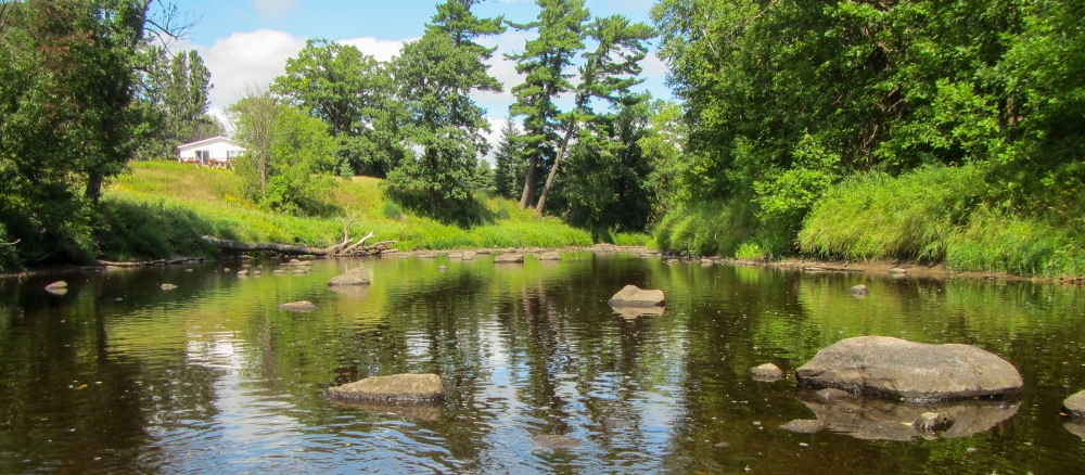
The MPCA and local partners found that the vast majority of streams in the watersheds meet water quality standards designed to protect fish and other aquatic life, and recreation. There are no lakes in the watershed, but many wetlands.
The MPCA assessed the health of fish and bugs in 12 stream sections and only one failed to meet the standard. One segment, the Lower Rapid River in the northeastern portion of the watershed, does not support aquatic life due to elevated levels of total suspended solids (TSS), mainly sediment, soil, and other particles in the water. Four streams fully support aquatic recreation and the remaining eight streams did not have sufficient data to assess aquatic recreation.
The TSS impairment required a total maximum daily load (TMDL) study to establish the amount of sediment the impaired stream can accept and still meet water quality standards, and the amount of reduction needed to meet the standard. The TMDL study is required by the federal Clean Water Act.
The second report, a watershed restoration and protection strategy (WRAPS) report, is required by the state Clean Water Land and Legacy Act and uses TMDL reports, monitoring results, and other information to develop strategies for restoring polluted waters and protecting healthy ones. Local partners will use this information to develop implementation plans and set priorities for projects.
Many of the water quality challenges in the watershed can be linked back to the legacy of a large-scale ditching campaign undertaken at the beginning of the 20th century to create agricultural land. The ditches failed to create usable farmland and fundamentally altered the hydrology of streams, creating less favorable conditions for fish and insects. This is because the ditches cause streams to experience higher flows during spring runoff and summer rain events and often low-flow conditions at other times. The effects of climate change amplify these conditions by producing more frequent and intense rain events while at other times causing drought condition.
The generally good water quality in the Rapid River Watershed is attributable to the forestlands and wetlands that cover more than 90 percent of the landscape. They absorb and filter precipitation, resulting in far less runoff carrying pollutants into lakes and streams.
Monitoring and assessment
Strategy development for restoration and protection
-
(EPA approval 3/23/2022)
-
(MPCA approval 2/17/2022)