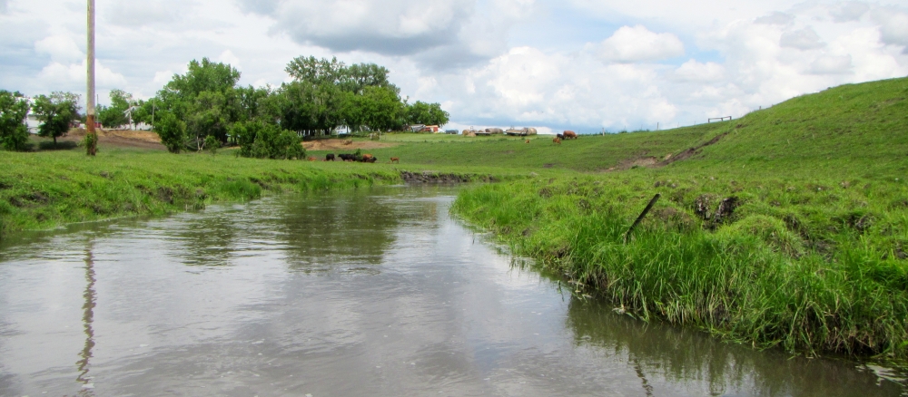
Buffalo River Watershed
Overview

Watershed at-a-glance
The Buffalo River flows 88 miles from the pine forests around Tamarac Lake in eastern Becker County to the Red River of the North, across the former beach ridges and the lake plain of the Glacial Lake Agassiz land formation. Nearly 1,200 square miles of Clay, Becker, Otter Tail, and Wilkin counties drain to the Buffalo.
| Hydrologic Unit Code (HUC) | 09020106 | [More Info] |
| Intensive monitoring start year | 2009 | [More Info] |
| Major lakes | Major rivers and streams |
|---|---|
|
Tamarac Lake, Buffalo Lake, Big Sugar Bush Lake, Boyer Lake |
Mainstem Buffalo, South Branch Buffalo, Hay Creek, Deerhorn Creek, Whiskey Creek, Stony Creek, Lawndale Creek |
Characteristics
The watershed is largely agricultural (row crops and pasture), accounting for more than 70% of the overall watershed acres. Development pressure is moderate to considerable in some areas.
Intensive monitoring shows that E.coli and turbidity are the most prevalent factors for rivers and streams. Shallow lakes in the watershed have issues with water clarity, chlorophyll, and nutrients leading to eutrophication.
What's being done
Intensive watershed monitoring and modeling is currently underway. Work is also being done to describe watershed conditions and conduct a survey of property owners.
MPCA's watershed approach: Since 2007, the MPCA and its partners have begun implementing a 10-year rotation for watershed restoration plans to address Minnesota's waters at the major watershed level.

[+] See large map
Watershed News
New report on water quality in Buffalo River watershed
It you are interested in learning more about the water quality in this watershed, be sure to check out the
Buffalo River Watershed Monitoring an Assessment Report.


Restoration and protection
The restoration and protection process
The MPCA and partner organizations evaluate water conditions, establish improvement goals and priorities, and take actions designed to restore or protect water quality on a 10-year cycle.
Monitoring and assessment
Projects in this watershed to test water quality conditions and determine whether our lakes, rivers, and wetlands are meeting state water quality standards. [More info]
| Project Name | Status |
|---|---|
| Becker County Citizens Lake Monitoring |
|
| Buffalo Red River WS Sediment Modeling |
|
| Buffalo Red River Watershed District 2011 |
|
| Buffalo-Red River Watershed Lake Monitoring |
|
| Red River Basin Condition Monitoring Network |
|
| Red River Basin Multi-Parameter TMDL Monitoring |
|
| Red River Basin River Watch Project |
|
| Red River Basin Stream Monitoring & Assessment |
|
| Red River North Retrospective Analysis |
|
| Red River Valley Biotic Assessment |
|
| Red River Watershed Management Board |
|
| Silver Lake Assessment Clay County |
|
| Tamarac NWR Baseline Water Quality Assessment |
|
| Tamarac WQ Study |
|
Reports
Data available for this watershed
Lakes and stream segments with condition and monitoring information
Lakes and streams are divided into "assessment units" for monitoring.
Impairments in this watershed listed by lake or stream segment
Generally, a waterbody has an impairment when it exceeds a particular pollutant standard.
Strategy development projects
Projects in this watershed that establish federal- or state-required plans for restoring water quality for impaired waters, or protecting high-quality waters. [More info]
| Project Name | Status |
|---|---|
| Buffalo River Major Watershed WRAP Strategy |
|
| Mercury Pollutant Reduction Plan |
|
| Red River of the North - Mainstem Impairments |
|
Implementation activities
Projects in this watershed to put water restoration or protection measures in place, ranging from best management practices to reduce runoff from fields or streets, to fixes to wastewater treatment facilities, to education activities for citizens and landowners. Implementation projects are supported by local, state and federal government sources, including Minnesota's new Clean Water Fund.
Our partners in the watershed are continually involved in these kinds of activities. See Contacts tab.
| Project Name | Status |
|---|---|
| Red River Basin Buffer Initiative |
|
Contacts
Jack Frederick, MPCA project manager
218-846-8110
John.Frederick@state.mn.us
Buffalo Red River Watershed District
123 Front St. PO Box 341
Barnesville MN 56514
218-354-7710
Maps
Watershed Map
Many of Minnesota’s lakes and streams do not currently meet water-quality standards because of pollution such as excess sediment or nutrients, bacteria or mercury. These waters are considered “impaired.” For more information, visit the impaired waters page.
The toggles show impaired waters and monitoring stations. Click on a site for more information.
Impairments in this watershed, listed by lake or stream segment
Generally, a waterbody has an impairment when it exceeds a particular pollutant standard.


