The Mississippi River - Sartell Watershed covers approximately 652,800 acres (1,020 sq. miles) in the central part of the Upper Mississippi River Basin. The watershed includes parts of Benton, Crow Wing, Mille Lacs, Morrison, Stearns, and Todd counties. Major communities: Lastrup, Pierz, Buckman, Royalton, Upsala, Bowlus, Rice, Holdingford, Avon, St. Joseph, and Sartell. This watershed has 879 total river miles and 232 lakes that cover 13,319 acres.
Located in the North Central Hardwood Forest ecoregion of Minnesota, the watershed is primarily agricultural, with approximately 96% of the land in this watershed under private ownership. The predominant land uses are grass/pasture/hay (35%), row crops (29%), forest (19%), and wetlands (9%).
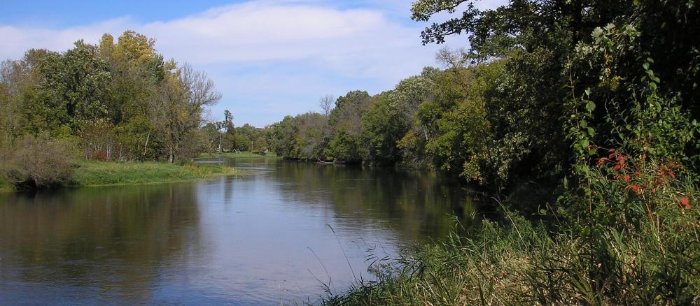
The Mississippi River experiences one of its greatest drops in elevation within the Upper Mississippi River Basin within this watershed. From Little Falls to Royalton, the river drops 6½ feet for every mile of river.
The Mississippi River flows through the central portion of this watershed and its confluence with several small creeks and streams is one of the significant natural features in this watershed. The lakes are primarily situated in the northeastern and southwestern corners of the watershed with a diverse network of tributaries located throughout the central region of the watershed. The excessively drained sand plain regions are some of the most intensively used lands within the watershed, and much of these areas are situated along the Mississippi River. These areas are sensitive to groundwater pollution and thus the implementation of best management practices is emphasized. Currently, there are two lakes and several streams within this watershed that do not meet Minnesota’s surface water quality standards for conventional parameter (not including mercury) pollutants. The shorelines of the lakes within this watershed tend to be developed and the tributary streams primarily flow through areas of agricultural land use.
The diverse surface water resources within this watershed provide important recreational opportunities and economic benefits to the citizens and visitors to the watershed. Working cooperatively to restore and protect these resources is vital in the sustainability of these essential assets.
The major threats to the watershed include:
- loss of shoreline buffers and habitat due to development
- introduction of large amounts of phosphorus, sediment, and bacteria to surface waters
- increased nutrient, contaminant, and sedimentation loading from stormwater runoff from development and other non-point sources
- loss of biodiversity due to competition from invasive species
- relatively high percentage of agricultural and urban/residential land uses within the riparian or sensitive areas of the watershed
- protecting drinking water supplies from bacteria impairments
Monitoring and assessment
Strategy development for restoration and protection
- (EPA approval 12/22/2020)
- (MPCA approval 11/20/2020)
Little Rock Creek and Little Rock Lake TMDLs
- (EPA approval 1/9/2017)
- (EPA approval 2/2/2012)
- (MPCA approval 3/14/2013)