The Mississippi River is essential to the high quality of life in the Twin Cities area and beyond. As a drinking water source and transportation corridor, it supports the region’s economic base. As an ecosystem, it provides food and habitat for fish, birds, and other wildlife. The ecosystem also supports the economy, as residents and tourists are attracted to boating and fishing on the water along with hiking and biking on many riverside trails.
The river is important to Minnesota for economic, ecological, recreational, and cultural reasons. However, the river suffers from high turbidity. In other words, the river has too much sediment or soil mixed with the water, to meet the state standard for aquatic life.
In Minnesota, nearly half of the state — about 50,000 square miles — drains to the river, along with small parts of South Dakota, Iowa, and Wisconsin. This water drains from farm fields and parking lots, and from all different types of land. It all mixes in the south metro Mississippi, meaning the river here is a blend of water from several geographical areas and different uses of land.
In addition, the river forms the boundary between Minnesota and Wisconsin, requiring the cooperation of both states. Scientists from the two states have worked together to measure the health of the river and plan for its restoration.
Map and location
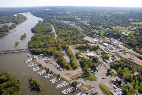
The South Metro Mississippi TMDL project includes the Upper Mississippi, Minnesota River, Cannon River and St. Croix River basins, as well as small rivers and streams in southeast Minnesota that flow directly into the Mississippi. The South Metro Mississippi, from river mile 844 at St. Paul to river mile 780 in upper Lake Pepin, is impaired by turbidity, meaning the water is too cloudy to meet the state water quality standard.
South Metro Mississippi TMDL project
Water clear enough to grow aquatic vegetation that benefits fish and wildlife is the goal of a project for the Mississippi River in the south metropolitan area of the Twin Cities. The project focuses on the river from Fort Snelling in St. Paul to upper Lake Pepin downstream of Red Wing. The river here suffers from high turbidity. In other words, the river has too much sediment — soil and other matter suspended in the river — to meet the water quality standard for support of aquatic life.
In addition, the sediment is filling in Lake Pepin, which could completely fill in, with a channel dredged for shipping, within 300 years.
The MPCA worked with a Stakeholder Advisory Committee, made up of representatives from agriculture, urban areas, wastewater treatment and other interests to study the problem and make recommendations on reducing the amount of sediment in the river. A Science Advisory Panel, made up representatives from universities and research groups, also advised the agency on the project.
Based on that input, extensive research, and 22 years of water monitoring data, the MPCA recommends the following reductions in the amounts of sediment flowing into the Mississippi:
- 60% from the Minnesota River during high and very-high flows and 50 percent during average and low flows;
- 50% from the Cannon River;
- 20% from the Upper Mississippi River; and
- 20% from smaller rivers and streams in Minnesota and Wisconsin that flow directly into the river
Restoring the Mississippi will require the efforts of residents, businesses and landowners from throughout Minnesota. This restoration will have ripple effects, resulting in cleaner water in the hundreds of streams and rivers flowing to the Mississippi. Implementation strategies for the South Metro Mississippi are available on the Sediment reduction strategy page.
- (EPA approval 4/26/2016)
- (EPA approval 6/9/2026)